


Research and Development
2022.06.30 Thu
Improvement of precipitation forecast accuracy by enhancing usage methods of JAXA satellite precipitation data in JMA
JAXA and the Japan Meteorological Agency (JMA) are jointly developing technology to improve the accuracy of weather forecasting, mainly precipitation, by utilizing three-dimensional precipitation observation data from the Dual-frequency Precipitation Radar (DPR) onboard the Global Precipitation Measurement Mission (GPM) core observatory. In March 2016, regular usage of GPM/DPR observation data started in the numerical prediction system that produces basic data for weather forecasting and disaster prevention weather information for JMA*1.
We are pleased to introduce that the usage of GPM/DPR observation data in the numerical prediction system at JMA will be upgraded from June 30, 2022, which will improve the accuracy of precipitation forecasts*2
*1 JMA and JAXA Joint Press Release (March 24, 2016)
“Usage of observation data from Global Precipitation Measurement Mission (GPM) core observatory in JMA”
*2 JMA Technical Information No. 590 on Distribution Materials (June 21, 2022)
“Accuracy improvement of global and meso model predictions by updating observation data application methodology”
■ Improvement in the usage of GPM/DPR
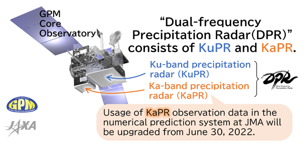
GPM/DPR consists of two kinds of precipitation radars, Ku-band precipitation radar (KuPR) and Ka-band precipitation radar (KaPR) as shown in Figure 1. By utilizing radio waves of two different frequencies (Ku-band and Ka-band), GPM/DPR observe rain and snow around the world from space. GPM/DPR is the world’s first precipitation radar with dual-frequency KuPR and KaPR. By utilizing the difference in observation results between Ku and Ka bands, it is possible to obtain information on precipitation particles, such as the detection of solid precipitation including hail and hailstorms (Specific example is here).
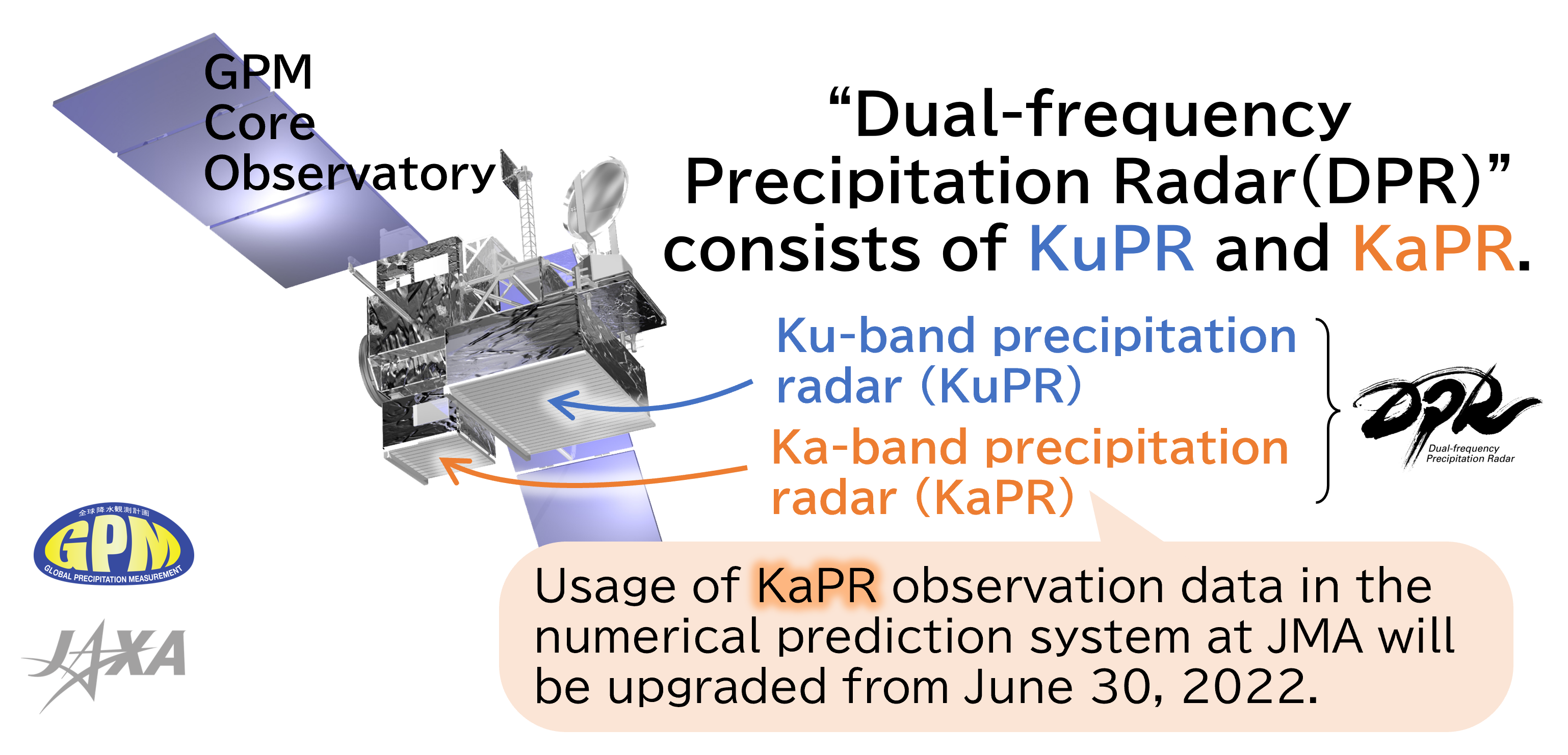
JAXA and NASA changed the scan pattern of KaPR as shown in Figure 2 on May 21, 2018, after transition to latter phase in operation (Details are here). Before this scan pattern change, dual-frequency information by Ku- and Ka-band radars could observe precipitation only in a narrow inner swath of 125 km since KaPR was observed with a high-sensitivity beam to fill in the gaps between the dual-frequency observation beams, whereas dual-frequency observation information can be applied in full swath of 255 km after the pattern change.
As a result of this improvement, KaPR data will now be available over a wider 255 km swath, similar to the KuPR data, although previously KaPR data was only available over a 125 km swath. This enables information on water vapor estimated from DPR data to be more accurately reflected in the initial values in the numerical prediction.
■Improvement of precipitation forecast accuracy by enhancing usage methods
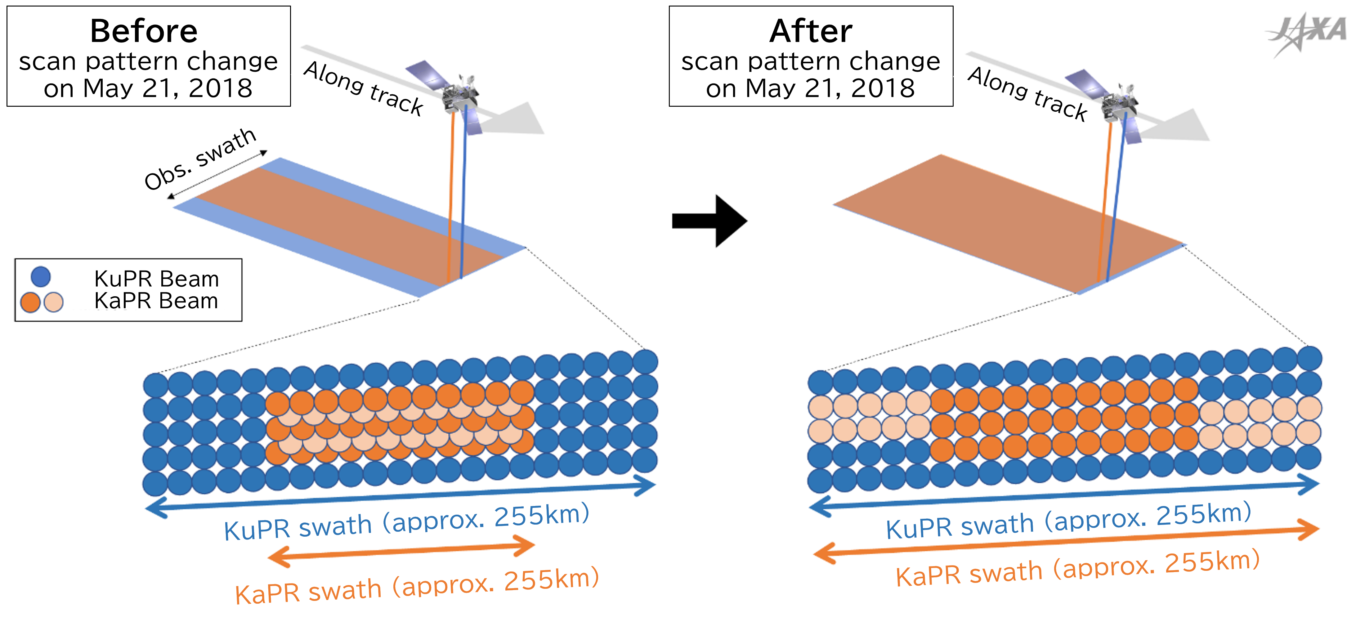
Based on JMA Technical Information No. 590 on Distribution Materials*2, we also introduce the effects of improved usage.
Figure 3 shows the prior 3-hour precipitation on the horizontal axis and the Threat Score on the vertical axis. For each of the GPM/DPR numerical forecast system before (blue) and after (red) improvement, the Threat Score results for precipitation above the value of the prior 3-hour precipitation on the horizontal axis are shown on the vertical axis. The result shows that the Threat Score is higher after the improvement than before the improvement, mainly for precipitation of 20 mm or more in the prior 3 hours, indicating that the accuracy of precipitation forecast has improved.
JAXA is working on research and development to improve the accuracy of satellite observation data, and will continue to contribute to the improvement of forecast accuracy through collaboration with the numerical prediction systems.
Related Site
The Global Precipitation Measurement (GPM) mission Website
JAXA 3D Rainfall Watch
Search by Year
Search by Categories


Tags
-
#Earthquake
-
#Land
-
#Satellite Data
-
#Aerosol
-
#Public Health
-
#GCOM-C
-
#Sea
-
#Atmosphere
-
#Ice
-
#Today's Earth
-
#Flood
-
#Water Cycle
-
#AW3D
-
#G-Portal
-
#EarthCARE
-
#Volcano
-
#Agriculture
-
#Himawari
-
#GHG
-
#GPM
-
#GOSAT
-
#Simulation
-
#GCOM-W
-
#Drought
-
#Fire
-
#Forest
-
#Cooperation
-
#Precipitation
-
#Typhoon
-
#DPR
-
#NEXRA
-
#ALOS
-
#GSMaP
-
#Climate Change
-
#Carbon Cycle
-
#API
-
#Humanities Sociology
-
#AMSR
-
#Land Use Land Cover
-
#Environmental issues
-
#Quick Report
-
#GOSAT-GW
Related Resources


Related Tags
Research and Development Related Articles
-
 Research and Development 2026.03.09 Mon High-Resolution Predictions of Global Terrestrial Water Cycle:
Today’s Earth – Global Updated -
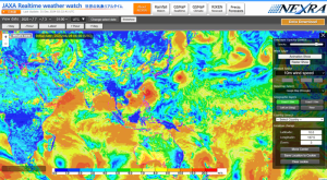 Research and Development 2025.06.18 Wed Advancing Space-Based Weather Analysis and Forecasting – Renewal of JAXA’s Realtime Weather Watch ‘NEXRA3’ and Performance Evaluation with the previous system (Overview Article)
 -
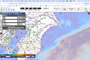 Research and Development 2025.03.27 Thu Launch of Ocean Weather Forecasts 1km resolution
 -
 Research and Development 2024.05.27 Mon The Use of Earth Observation Satellite Data in the Humanities and Social Sciences (3)
Stay Connected
