


Remote sensing and radiative transfer
What is remote sensing?
Remote sensing is a technology for measuring (sensing) the shape and characteristics of an object from a distant place (remote) without touching the object.
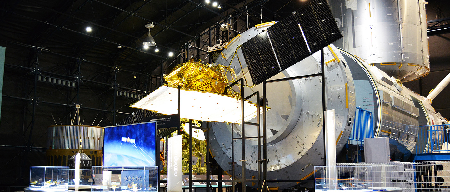
Earth observation satellites measure natural phenomena and disasters on the Earth, and changes that human activities cause to the Earth, from space far above the Earth. We can say that the satellites are performing “remote sensing“.
Remote sensing by Earth observation satellites
What exactly is remote sensing of the Earth from space?
Earth observation satellites mainly observe electromagnetic waves emitted and reflected from the Earth in order to measure the state of the atmosphere and the global environment near the Earth’s surface and natural phenomena from space far above the earth.
The most familiar example of “electromagnetic waves” is “visible light” which we can see. However, as shown in Figure 1, visible light refers to electromagnetic waves in only a small part of the wavelength band. There are other electromagnetic waves with longer wavelengths than visible light, called “infrared waves” and “microwaves.” The electromagnetic waves in the visible, infrared, and microwave wavelengths are widely used in Earth observation.
Because the sensors (observation instruments) onboard Earth observation satellites can catch these electromagnetic waves in a wide range of wavelengths, it is possible to capture images of the Earth that we cannot normally see with our eyes, as shown in Figure 1.
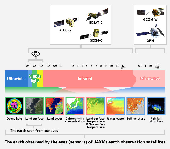
Examples of Earth observation data obtained in each wavelength range
Mechanism of remote sensing
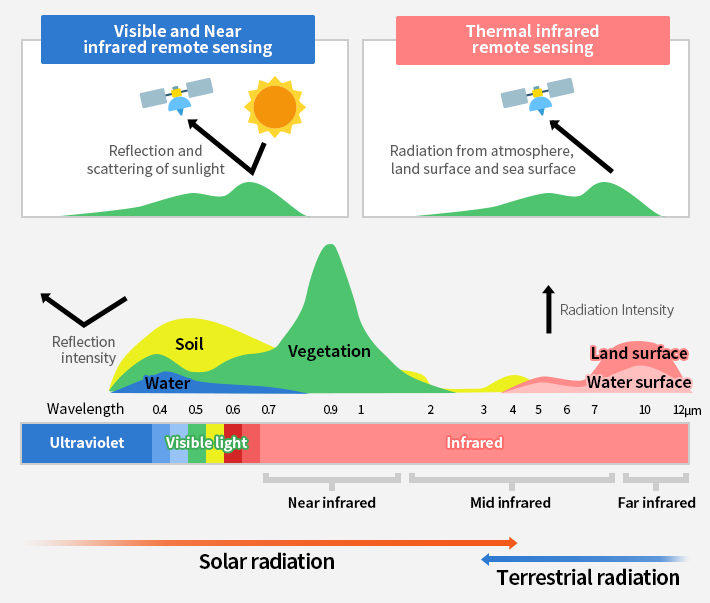
How do Earth observation satellites use electromagnetic waves of various wavelengths to observe various aspects of the Earth? We briefly explain the observation mechanism, with diagrams, for the relatively short wavelengths of visible light and near-infrared, and the longer wavelengths of thermal infrared and microwaves.
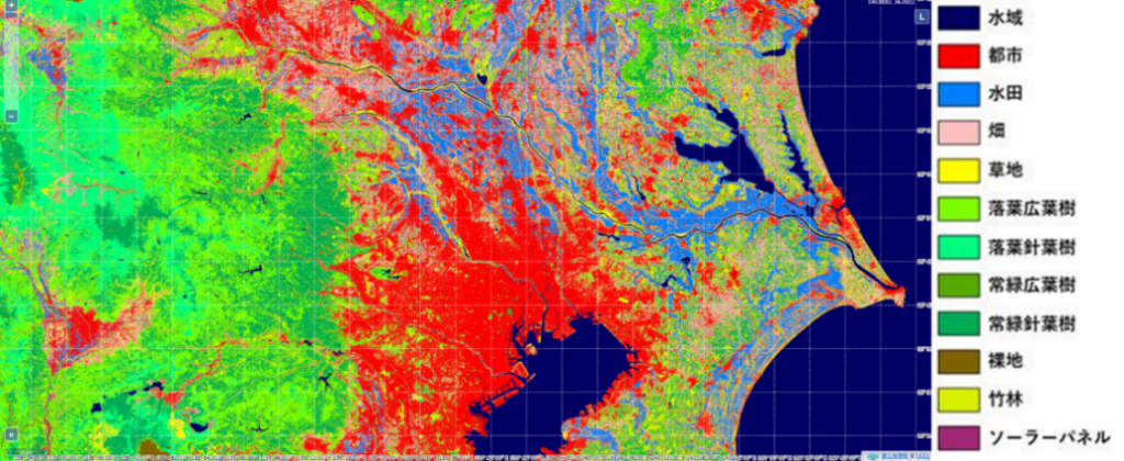
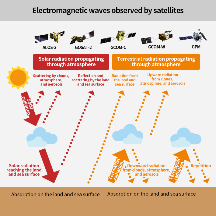
Electromagnetic waves in the visible and near-infrared wavelength ranges is mostly included in “solar radiation” (sunlight). Earth observation satellites that catch visible light and near-infrared waves, observe electromagnetic waves which solar radiation is reflected, scattered, and absorbed by the Earth’s surface. For example, as shown in Figure 2, in visible light and near-infrared waves, the wavelength of strongly reflected electromagnetic waves changes depending on the condition of the ground surface (plant, soil, water, etc.). This characteristic can be used to obtain information on the land cover of the Earth’s surface (city or forest, type of vegetation, etc.) from satellite data (Figure 3 (a)).
On the other hand, electromagnetic waves in the thermal infrared and microwave wavelength ranges is mostly included in the electromagnetic waves emitted by the earth (earth’s surface and atmosphere), which is “terrestrial radiation”. Electromagnetic waves in the thermal infrared and microwave ranges are constantly emitted and scattered from the earth’s surface and atmosphere, though usually invisible to our eyes. Satellite captures the intensity of the terrestrial radiation, which varies depending on the state of the earth’s surface and atmosphere, as shown in Figure 2. (The microwave range is not shown in Figure 2. In the case of microwaves, the relative intensity of the radiation between the observed frequencies is used.)
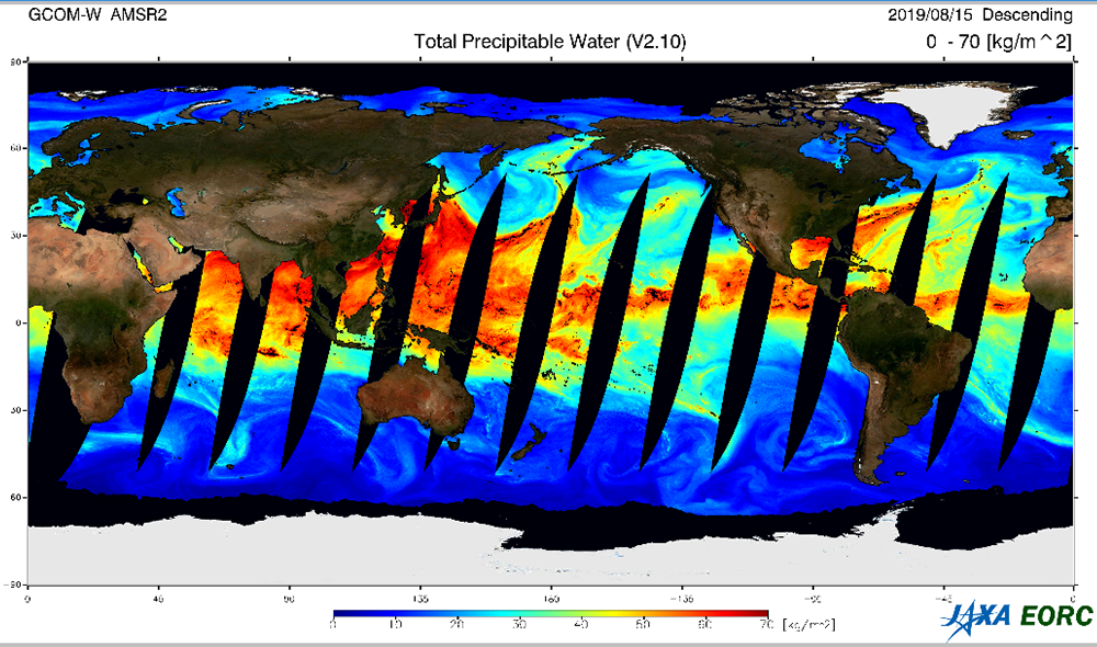
It is possible to know the temperature of the earth’s surface and the amount of water vapor in the atmosphere (Fig. 3 (b)) by observing terrestrial radiation. Since these data do not require solar radiation to be observed, they have the advantage of being available day and night, and are used in familiar fields such as weather forecasting.
Some Earth observation satellites equipped with sensors that not only receive reflected/scattered light from solar radiation and radiation from the Earth’s surface and atmosphere, but also actively emit electromagnetic waves and observe the reflected/scattered electromagnetic waves. Sensors that only receives electromagnetic waves are called “passive sensors”, while those that emits and receives electromagnetic waves are called “active sensors”.
Radiative transfer calculation
How do we convert the intensity of solar and terrestrial radiation observed by the satellite (Figure 2) into land cover information and physical quantities such as and atmospheric water vapor (Figure 3)? To find out, we need to go one step further and learn about radiative transfer calculation, which is essential for remote sensing from space.
Radiative transfer calculation is used to calculate how electromagnetic waves from the sun propagate through the atmosphere and reach to the Earth’s surface, and how scattered light and radiation from the earth’s surface and atmosphere propagate out into space. Based on this radiative transfer equation, radiation intensity observed by satellites can be converted into information about the Earth’s surface and atmosphere. Fig. 4 shows the schematic diagram of the radiative transfer of solar and terrestrial radiation. Satellites observe both radiations at the point where they are emitted into space after repeated absorption, scattering, and radiation by the earth’s surface and atmosphere.
Figure 4 shows a simple example, but actually for remote sensing from space, the state of the earth’s surface, such as vegetation and snow cover, and the state of the atmosphere, such as rain and wind, also affect the radiation intensity. In order to estimate the actual state of the Earth and atmosphere from the observation data, it is necessary to construct algorithms to estimate physical quantities based on radiative transfer calculations that take these complex processes into account as much as possible. In remote sensing from space, the radiative transfer calculation is a very important basis for more accurate estimation of the state of the Earth and atmosphere.


Stay Connected
