Geospatial information is information that indicates a point or area in space and the information associated with it. Geospatial information is being used in a variety of ways, such as for understanding the disaster situation and for business purposes such as maps.
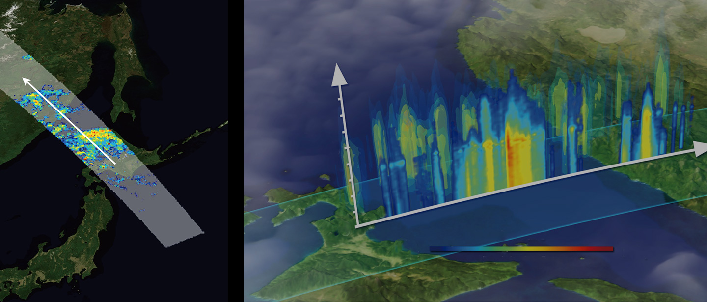
In order to collect geospatial information which changes daily, manual surveying, aircraft, and recently drones are traditionally used. However, these methods require a lot of time and money because the range that can be measured and photographed at one time is limited. Therefore, the data use of Earth observation satellites, which can observe a wide area, makes it possible to collect information efficiently.
For example, the Geospatial Information Authority of Japan (GSI) of the Ministry of Land, Infrastructure, Transport and Tourism (MLIT) used optical sensor data from ALOS to study the location of remote islands and update topographic maps. As a result, the topographic map of Iwo Jima was updated for the first time in about 25 years (Figure 1).
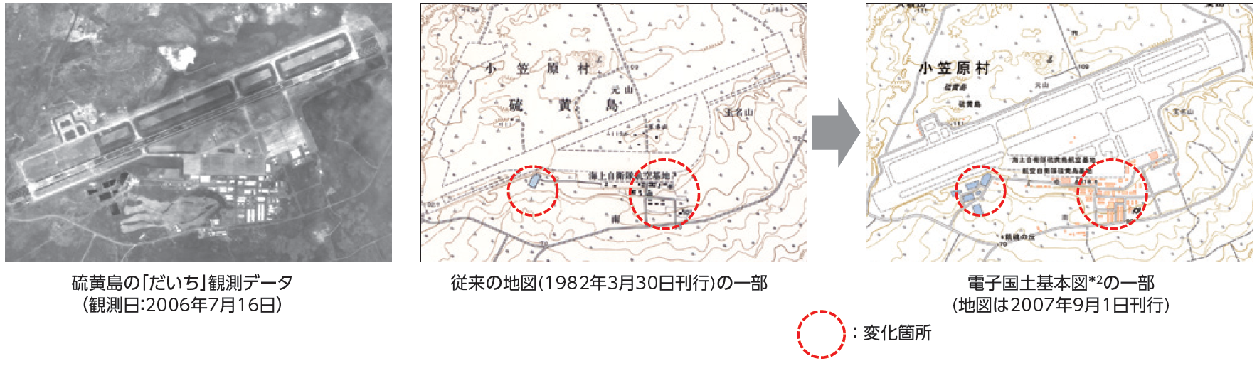
Figure 1: Update of Iwo Jima Map using ALOS data
Some countries that do not have well-developed maps are using satellite data to produce maps and understand the situation of their land.
Using a massive amount of satellite data, it is also possible to produce a 3D map of the entire world. This can be used for urban development, disaster simulation, etc. (Figure 3).
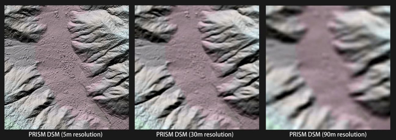
Figure 2: Example of 3D map at different resolutions.
(left) 5 m resolution, (center) 30 m resolution, (right) 90 m resolution
The Earth’s surface can change slowly and invisibly due to natural phenomena such as earthquakes and volcanic eruptions, as well as human factors such as land subsidence. By using data from Synthetic Aperture Radar (SAR) sensors onboard ALOS series, we will be able to capture these changes visibly (Figure 3).
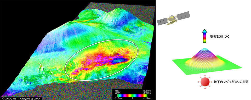
Figure 3: Interferometric image of Hawaii Island in 2006 and interpretation
Satellite data has been used to efficiently collect geospatial information widely. It is expected that the monitoring work by humans and aircraft can be carried out more efficiently by using or substituting satellite data. Also, by combining satellite data with other data, we will contribute to the realization of Society 5.0 and Digital Transformation (DX).