In Japan, there are significant social issues such as the serious aging of civil infrastructure built during the period of rapid economic growth, the increasing cost of maintenance and renewal, and the shortage of manpower and skilled workers in the field.
To monitor the daily changing displacement of civil infrastructure with the human eye or an aircraft, it takes a lot of time and costs. Therefore, by using Synthetic Aperture Radar (SAR) sensor, which is capable of observing targets at once in a wide field of view, we can monitor urban land subsidence and infrastructure facilities (gas pipelines, etc.).
For example, Jakarta, the capital of Indonesia, is rapidly developing, while land subsidence is frequently occurring due to increased use of groundwater. At the request of the Indonesian government, the Japan International Cooperation Agency (JICA) has been monitoring land subsidence using satellite data (Figure 1).
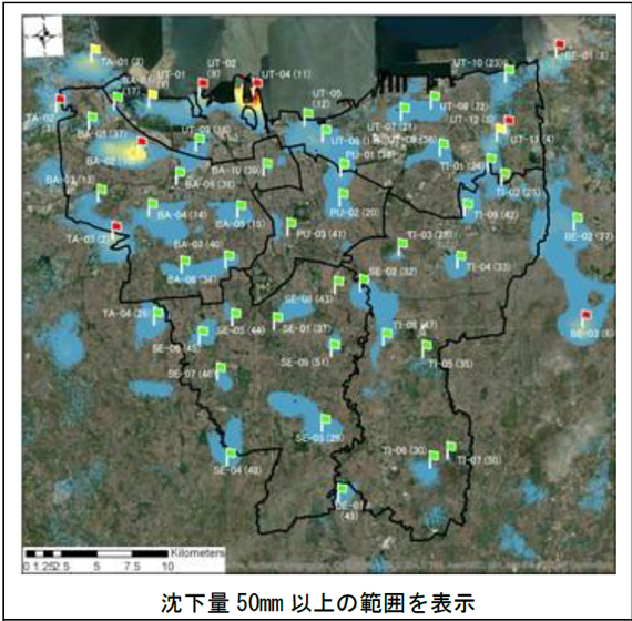
Figure 1: Land subsidence distribution based on satellite image analysis
(Source: “JICA Project Brief Note”)
Satellite data has been used to efficiently maintain and inspect civil engineering and infrastructure. It is expected that the monitoring work by humans and aircraft can be carried out more efficiently by using or substituting satellite data. Also, by combining satellite data with other data, we will contribute to the realization of Society 5.0 and Digital Transformation (DX).