


Disaster
2021.11.02 Tue
Satellite observation information on pumice stones approaching and drifting to the main island of Okinawa (follow-up report)
Overview:
This is a follow-up report of the “Satellite observation information on pumice stones approaching and drifting to the main island of Okinawa” released on October 29. In the previous report, we introduced the observation information on pumice stones captured by the Global Change Observation Mission – Climate “SHIKISAI” (GCOM-C) and the Advanced Land Observing Satellite-2 “DAICHI-2” (ALOS-2). This time, we introduce pumice observation captured by the satellites, which are being operated by the foreign space agency.
If you have any inquiries, please contact at: earth*ml.jaxa.jp (please replace * with @)
Reference: The article about the eruption of Fukutoku-Okanoba (creation of new islands, pumice stones, etc.) was released on Earth-graphy on October 7.
Also, the latest GCOM-C images related to the pumice stones are posted on the special website (Japanese only).
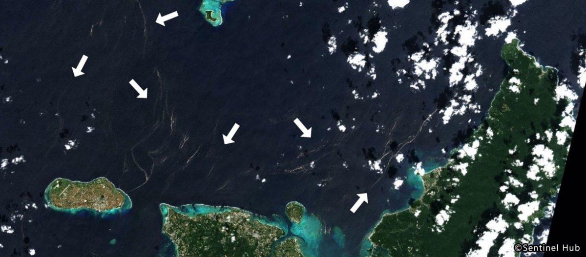
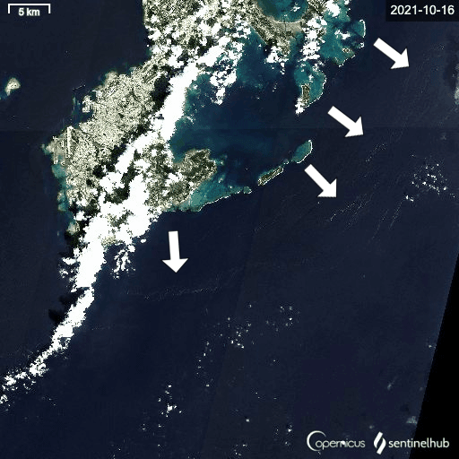
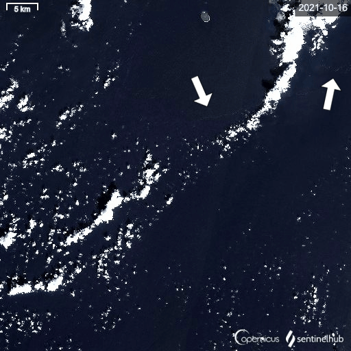
1. Pumice observation by ESA optical satellite, “Sentinel-2”
The Sentinel-2 satellites operated by ESA have 13 spectral bands in total that range from the Visible to the Short Wave Infra-Red, with a swath width of 290 km and a spatial resolution of 10 m for visible bands. With two satellites, Sentinel-2 is constantly observing the Earth’s surface and revisits the same spot every five days in areas lower than +/-84 degrees latitude, including Okinawa.
The following are images observed around the main island of Okinawa captured by Sentinel-2 on October 16, 26, and 31 with relatively less cloud cover. The gray streaks indicated by white arrows in the figs. are likely to be pumice distribution.
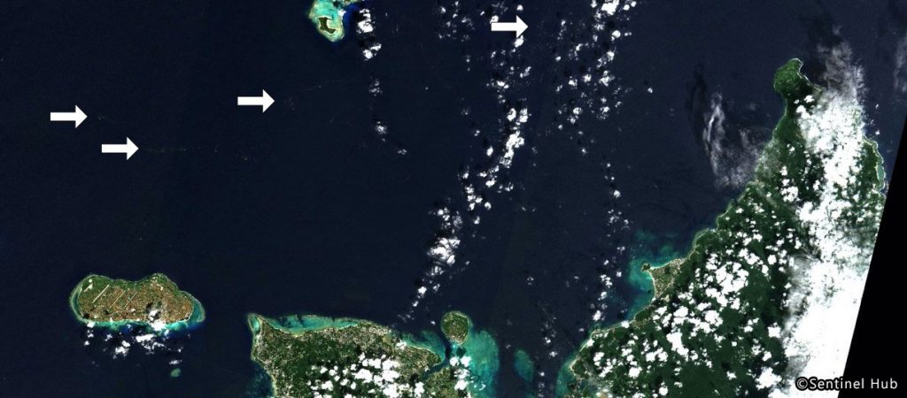

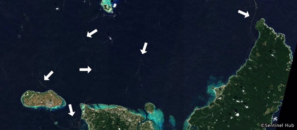
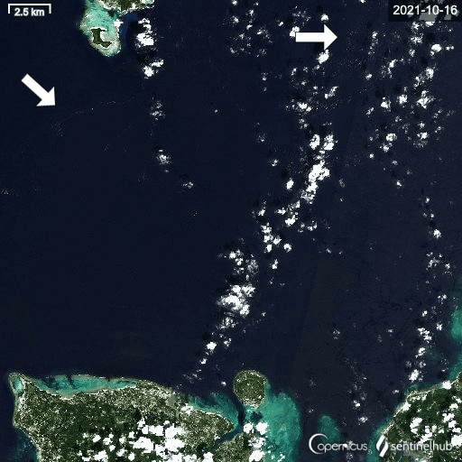
Followings are Sentinel-2 True Color images around the main island of Okinawa except northwestern side.
We will continue to provide the information to relevant organizations using Earth observation images of JAXA satellites such as GCOM-C and ALOS-2, and also those from foreign space agencies.
Search by Year
Search by Categories


Tags
-
#Earthquake
-
#Land
-
#Satellite Data
-
#Aerosol
-
#Public Health
-
#GCOM-C
-
#Sea
-
#Atmosphere
-
#Ice
-
#Today's Earth
-
#Flood
-
#Water Cycle
-
#AW3D
-
#G-Portal
-
#EarthCARE
-
#Volcano
-
#Agriculture
-
#Himawari
-
#GHG
-
#GPM
-
#GOSAT
-
#Simulation
-
#GCOM-W
-
#Drought
-
#Fire
-
#Forest
-
#Cooperation
-
#Precipitation
-
#Typhoon
-
#DPR
-
#NEXRA
-
#ALOS
-
#GSMaP
-
#Climate Change
-
#Carbon Cycle
-
#API
-
#Humanities Sociology
-
#AMSR
-
#Land Use Land Cover
-
#Environmental issues
-
#Quick Report
-
#GOSAT-GW
Related Resources


Disaster Related Articles
-
 Disaster 2025.10.23 Thu ALOS-2 Observations of the Earthquakes in the Philippines
(Cebu Island and Mindanao Island) -
 Disaster 2025.04.04 Fri ALOS-2 Observation of the M7.7 Earthquake in Myanmar
 -
 Disaster 2024.09.09 Mon ALOS-2 Observation of the Oil Spill Caused by the Sinking of a Tanker in Manila Bay, Philippines
 -
 Disaster 2023.04.07 Fri ALOS-2 observation: Oil spill from sunken oil tanker off Mindoro Island, Philippines (follow-up report)
Stay Connected
