


Disaster
2021.10.07 Thu
The eruption at Fukutoku-Oka-no-Ba volcano and new islands – Satellite monitoring of creation of new islands, discolored seawater, pumice stones, volcanic gas and plumes –
■Overview
A large-scale eruption occurred at Fukutoku-Oka-no-Ba submarine volcano on August 13, 2021 and two new islands were created. Observation of sea-area volcanoes is important to keep safety of ship navigation and understand our territory and territorial waters correctly, however, these areas are very remote and difficult to observe frequently by aircraft or other means. Therefore, JAXA has provided satellite observation results to domestic volcano related organizations (Japan Meteorological Agency (JMA), Japan Coast Guard (JCG), etc.) for cooperation. In this article, we introduce the creation of new islands, its subsequent changes, and volcanic activities before eruption (discolored seawater) captured by satellite at Fukutoku-Oka-no-Ba. We will proceed to provide information to related organizations and develop satellite application technologies for monitoring the activity of sea-area volcanoes.
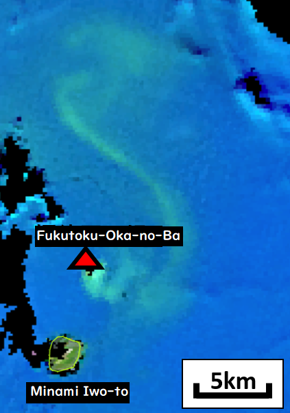
(Discolored seawater (green parts) is spreading about 20 km around the island and the north side.)
(September 5, 2021)
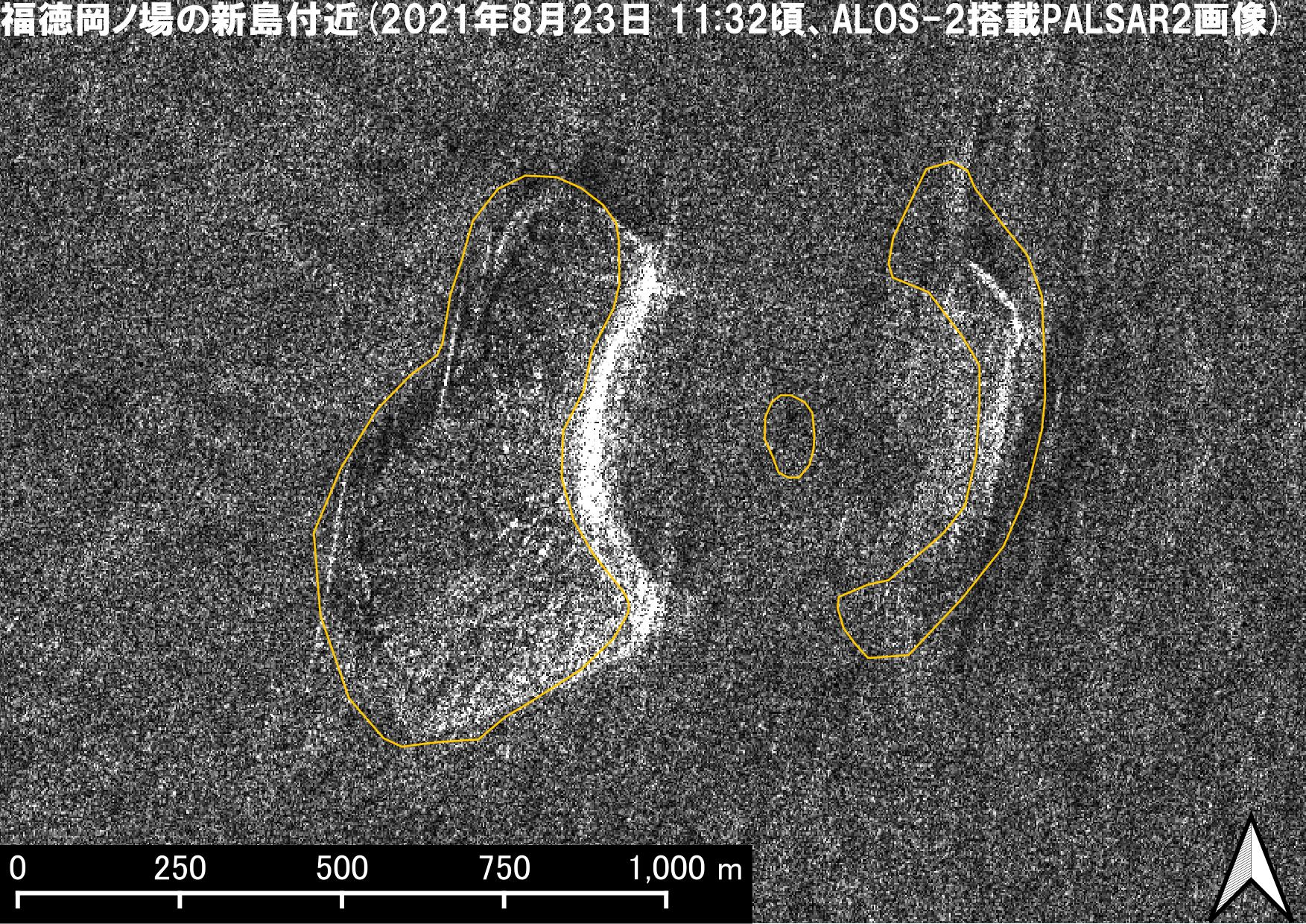
(New islands created by the eruption can be seen on the east and west side.)
(August 23, 2021)
(August 12 – 14, 2021)
*All satellite observation dates in this article are Japan time.
■About Fukutoku-Oka-no-Ba
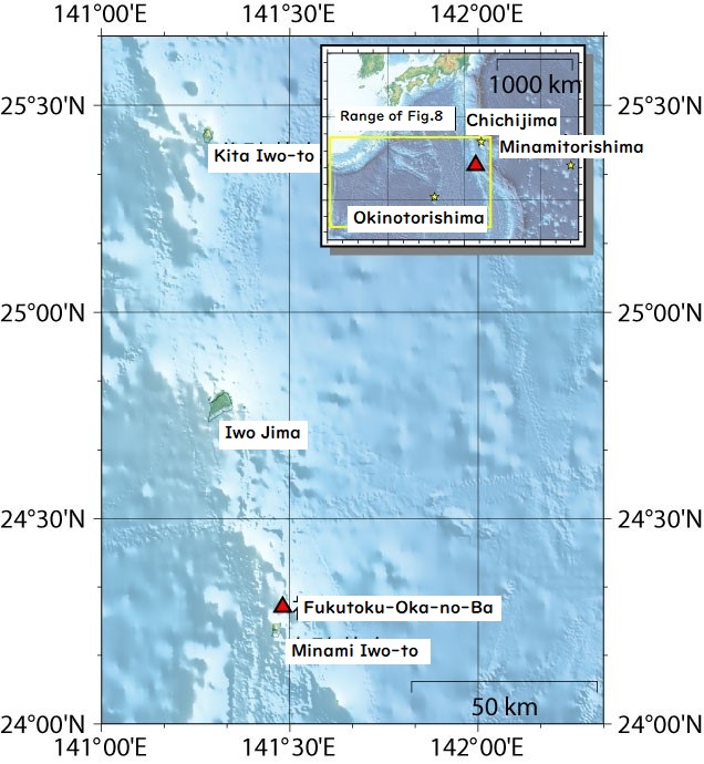
Fukutoku-Oka-no-Ba is a submarine volcano located 1,300 km south of Tokyo. Its location is almost the same distance as from Tokyo to Amami Oshima (Figure 4). Fukutoku-Oka-no-Ba is the central cone of the Kita-Fukutoku Caldera (north–south and east–west length of 16 and 10 km, respectively) at the mountain top of the complex volcano, “Kita-Fukutokutai” (north–south and east–west length of 40 and 20 km, respectively, relative elevation is 2,000 km). New islands were created due to eruptions occurred in 1904, 1914 and 1986, however, all were eroded and disappeared later on. For more details, please refer to the description of JMA (National catalogue of the active volcanoes in Japan) and “Fukutoku-Oka-no-Ba” (Global Volcanism Program, Smithsonian Institution).
■Overview of the eruption
This time, the volcanic column at Fukutoku-Oka-no-Ba reached as high as 16 km into the stratosphere (the document released from JMA). This seems to be Plinian eruptions, which eject a large amount of volcanic ash and pumice stones. In case the volcanic column reaches the stratosphere and a large amount of volcanic ash spreads over the entire globe, it would cause extreme weather events. Recently, the case of Mount Pinatubo (1991 Eruption) and Mount St. Helens (1980 Eruption) are known. As for the explanation of eruption types including Plinian, please refer to “Eruption Classifications” (National Park Service, United States).
■Creation of new islands and the subsequent changes
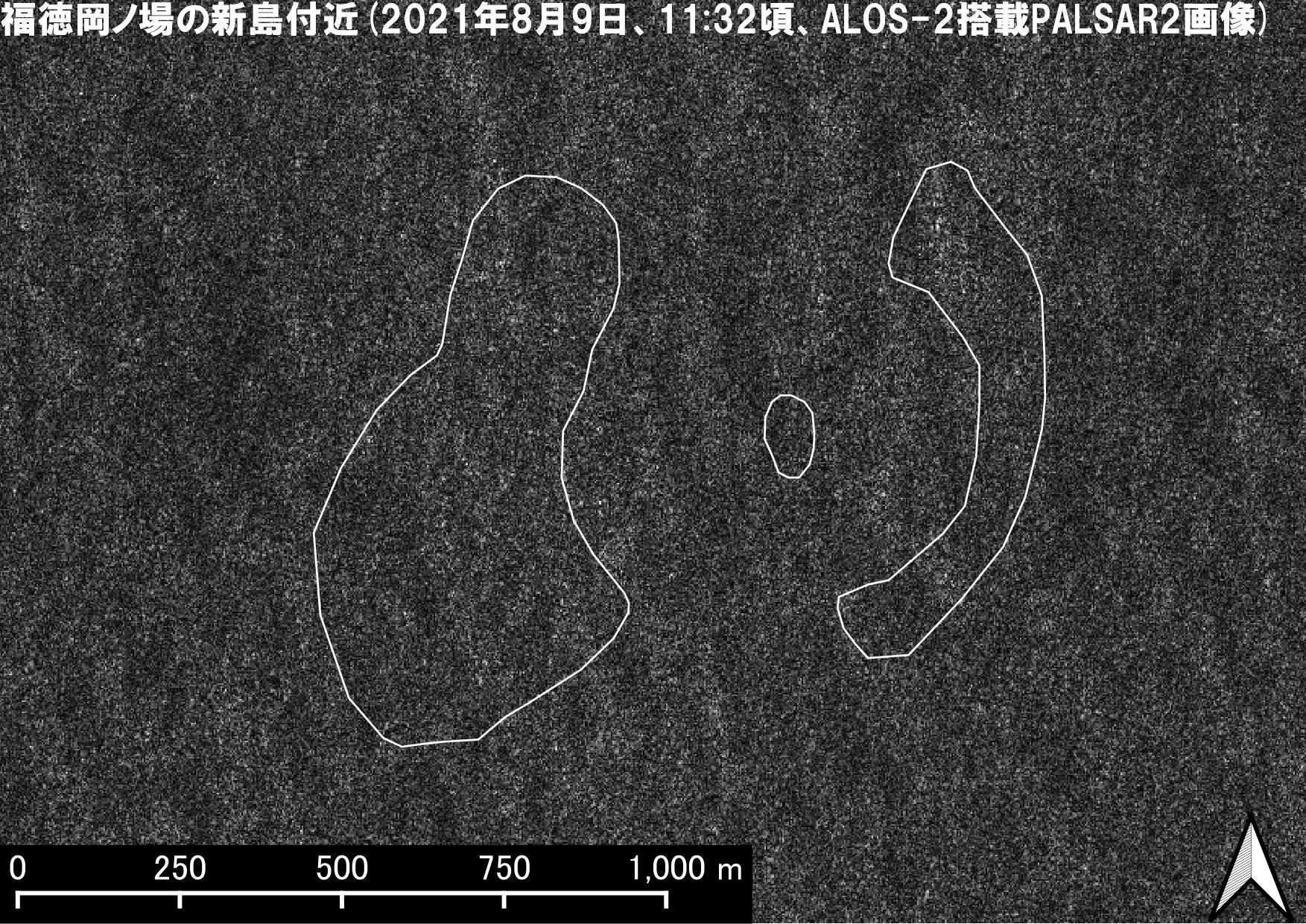
Historically, new islands were created in 1904, 1914 and 1986 at Fukutoku-Oka-no-Ba, however, all were eroded and disappeared later on. JAXA is paying attention to the situation of new islands by analyzing observation results from multiple satellites such as the Advanced Land Observing Satellite-2 “DAICHI-2” (ALOS-2), which performs observation regardless of the weather conditions and Landsat 8 operated by the United States Geological Survey (USGS).
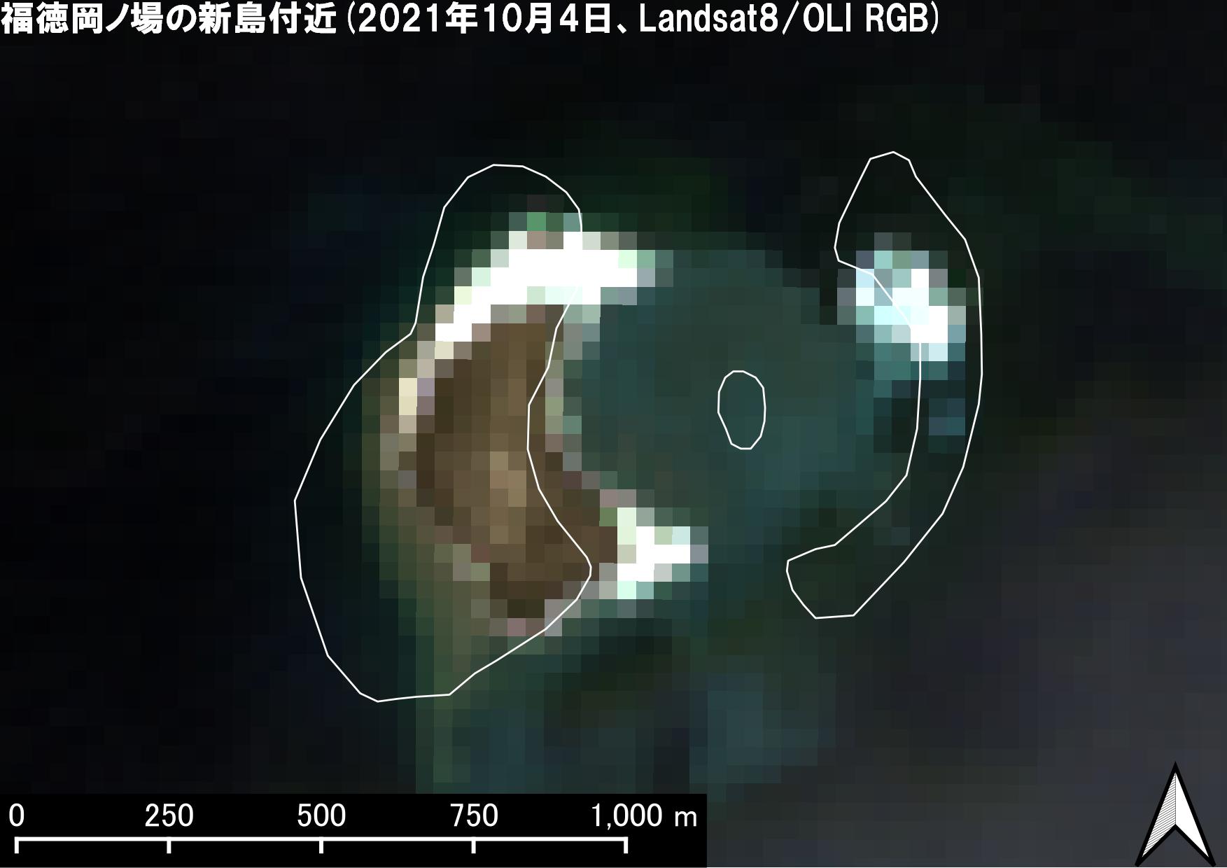
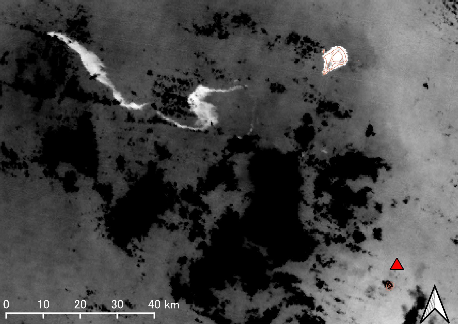
Table 1 shows the analysis results from satellite observation data of new islands at Fukutoku-Oka-no-Ba. To know the change of new islands’ form, the coastline analyzed from the Landsat 8 image captured on August 17 was added to each image. Two new islands in the east and west side of crater were identified on August 17 and 23, however the east island cannot be seen clear in later satellite images. It appears to have been eroded. The ocean surface at the location of the east island looks different from normal on September 18 and 20. After that, it seems that the coastline of west island has also receded and the island became smaller on October 4. We will pay close attention to the condition watching the effect of the ocean surface waves.
| Landsat8 image | ALOS-2 image | |
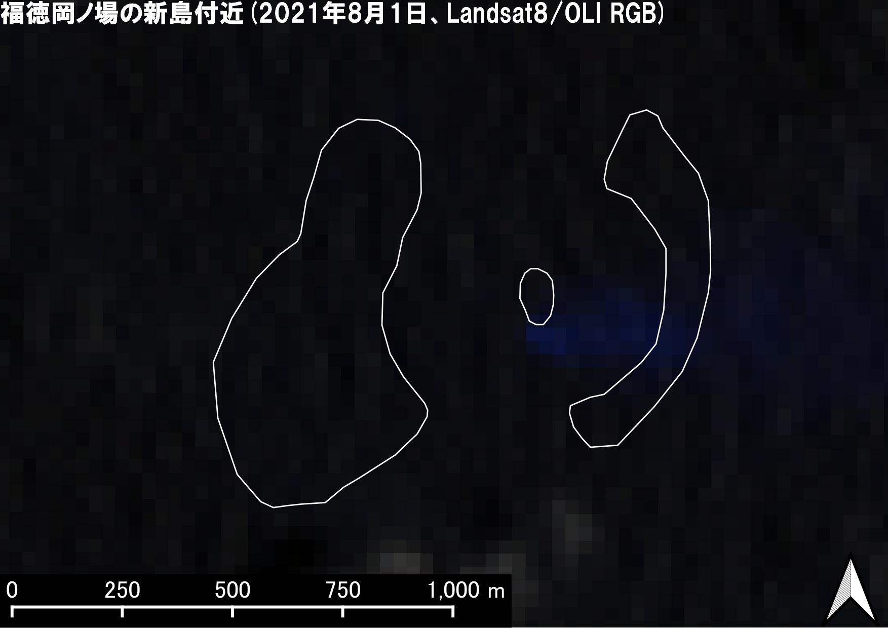 August 1 (pre-eruption) |
 August 9 (pre-eruption) |
·In both images, there is no island shape. |
| GCOM-C image | ||
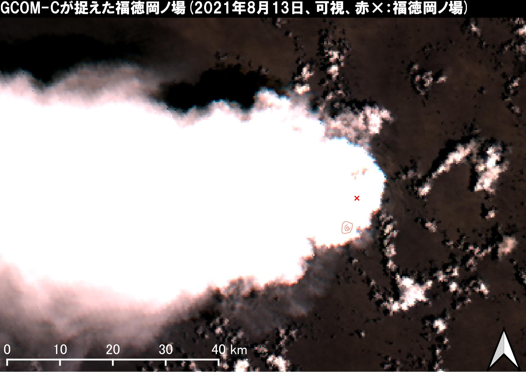 August 13 (the day of eruption) |
The eruption occurred at Fukutoku-Oka-no-Ba. (Announcement of JMA and JCG) ·GCOM-C captured volcanic plumes over Fukutoku-Oka-no-Ba. |
|
| Landsat 8 image | ALOS-2 image | |
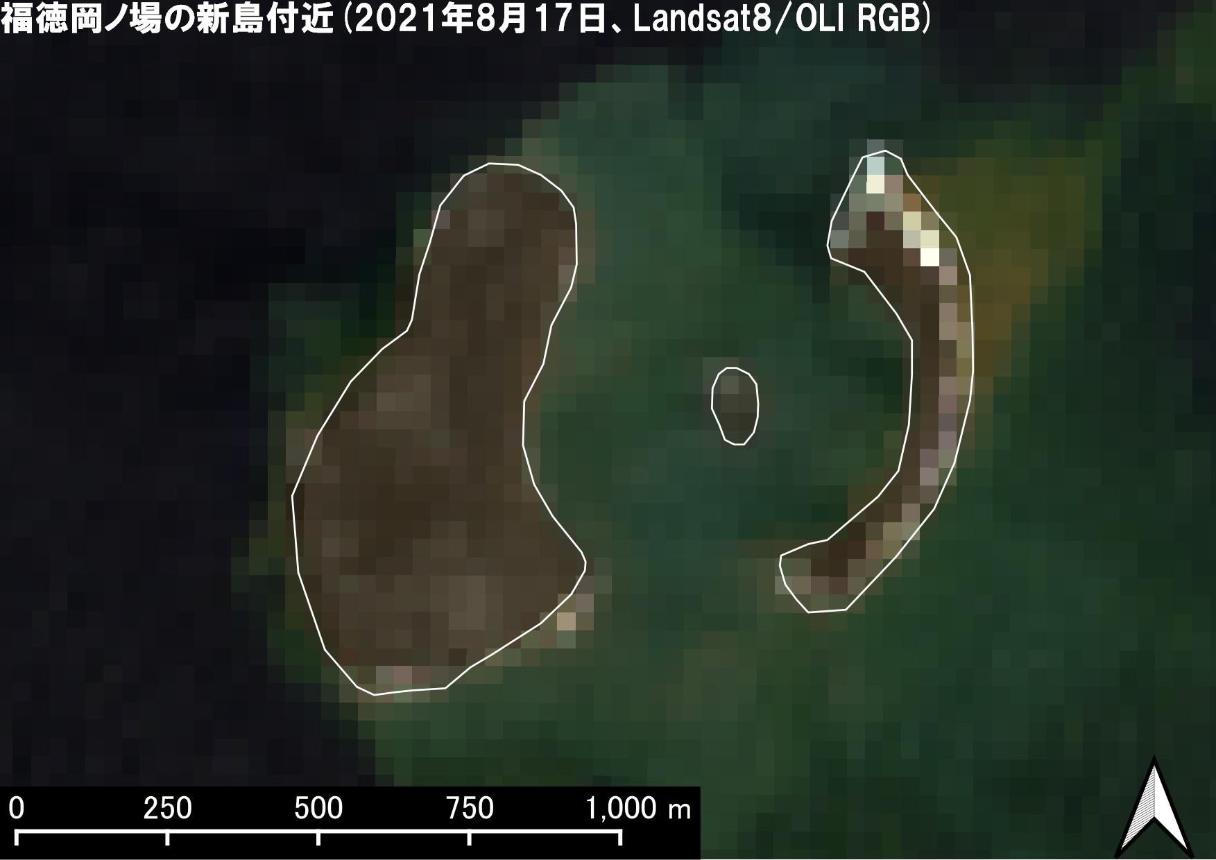 August 17 |
 August 23 |
·Landsat 8: Two new islands on the east and west were identified. ·ALOS-2: The western new island remained the same, but the eastern new island appeared to be unclear compared to Landsat 8 image. |
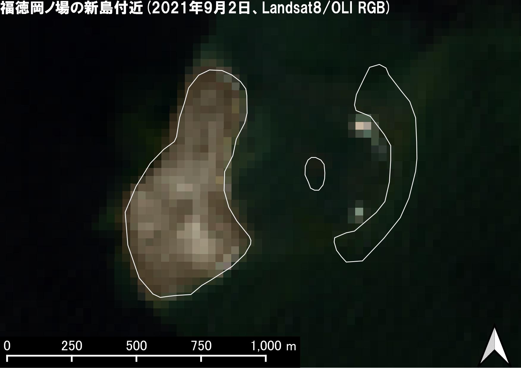 September 2 |
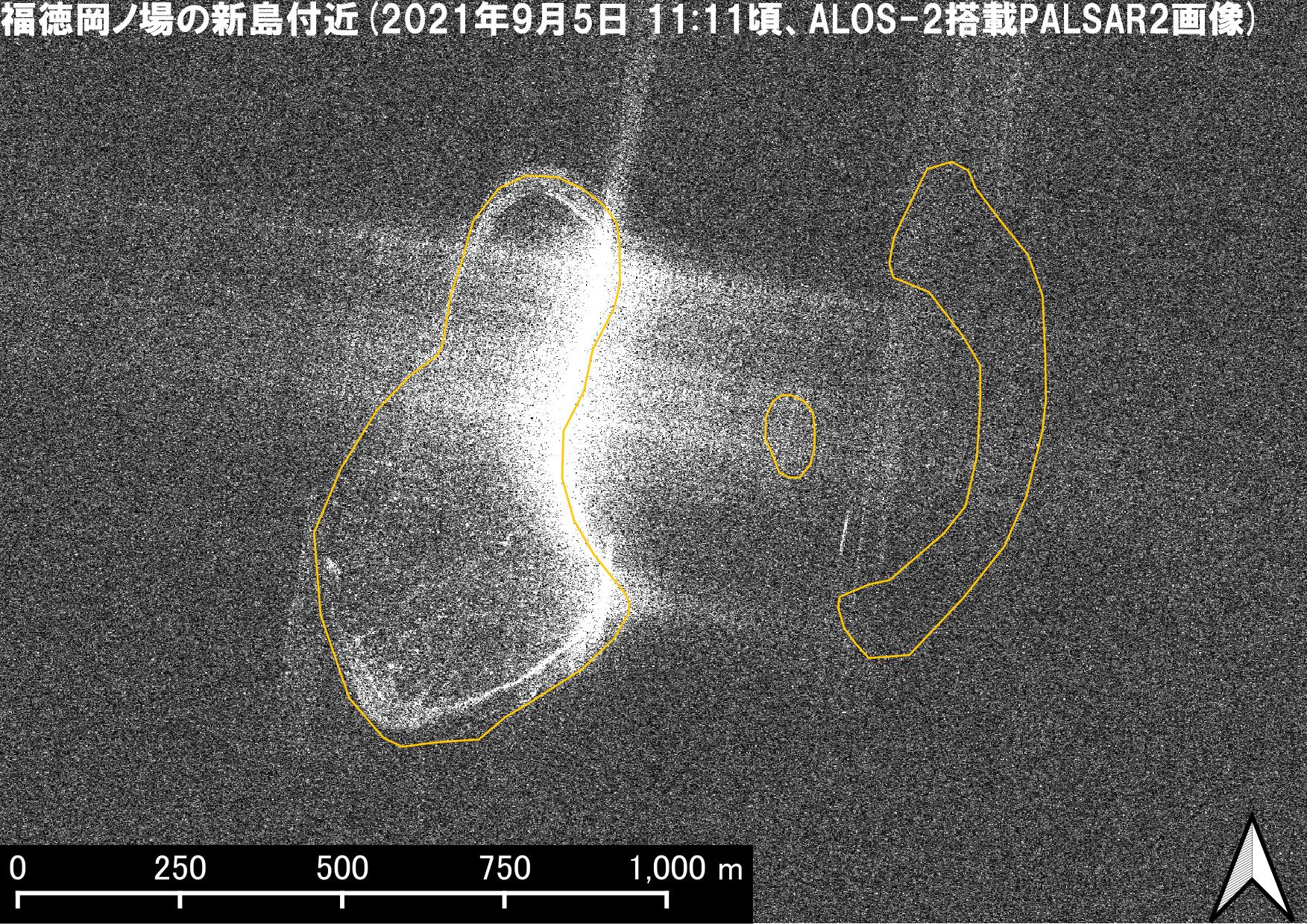 September 5 |
·Landsat 8: The size of the western new island remained the same, but the part of the eastern new island became submerged and only what appears to be foaming waves could be observed. ·ALOS-2: The size of the western new island remained the same, but the eastern new island could not be found. |
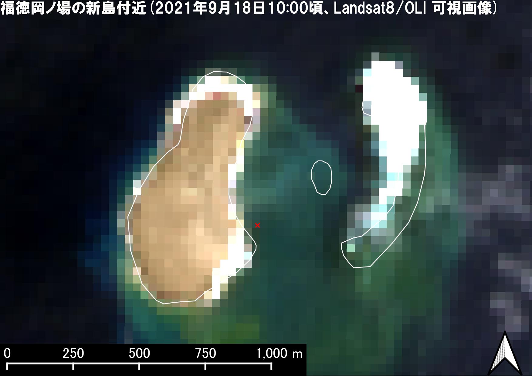 September 18 |
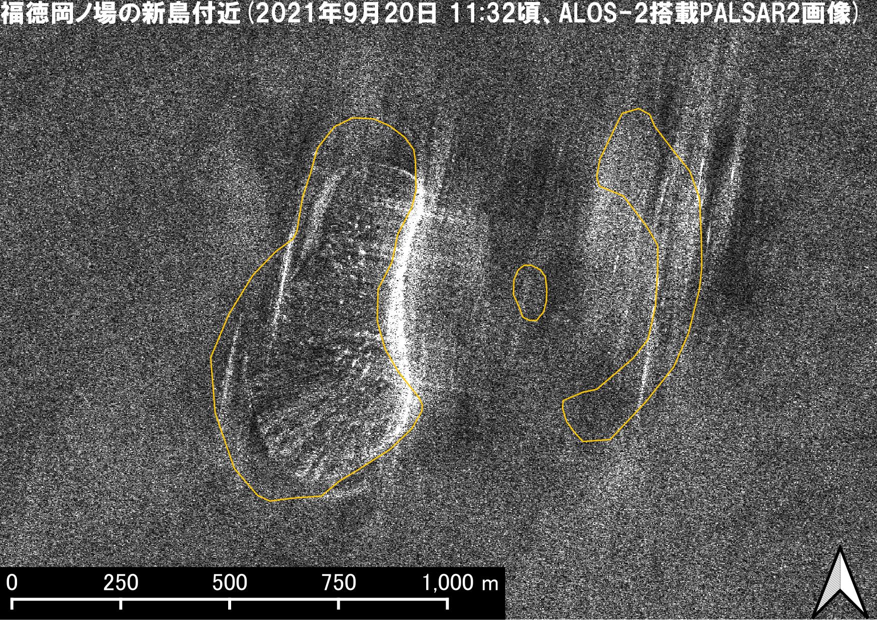 September 20 |
·Landsat 8: The size of the western new island remained the same, but the part of the eastern new island became submerged and only what appears to be foaming waves could be found. ·ALOS-2: The north end coastline of the western new island has slightly receded. Weak reflection could be seen at the location of the eastern new island. |
 October 4 |
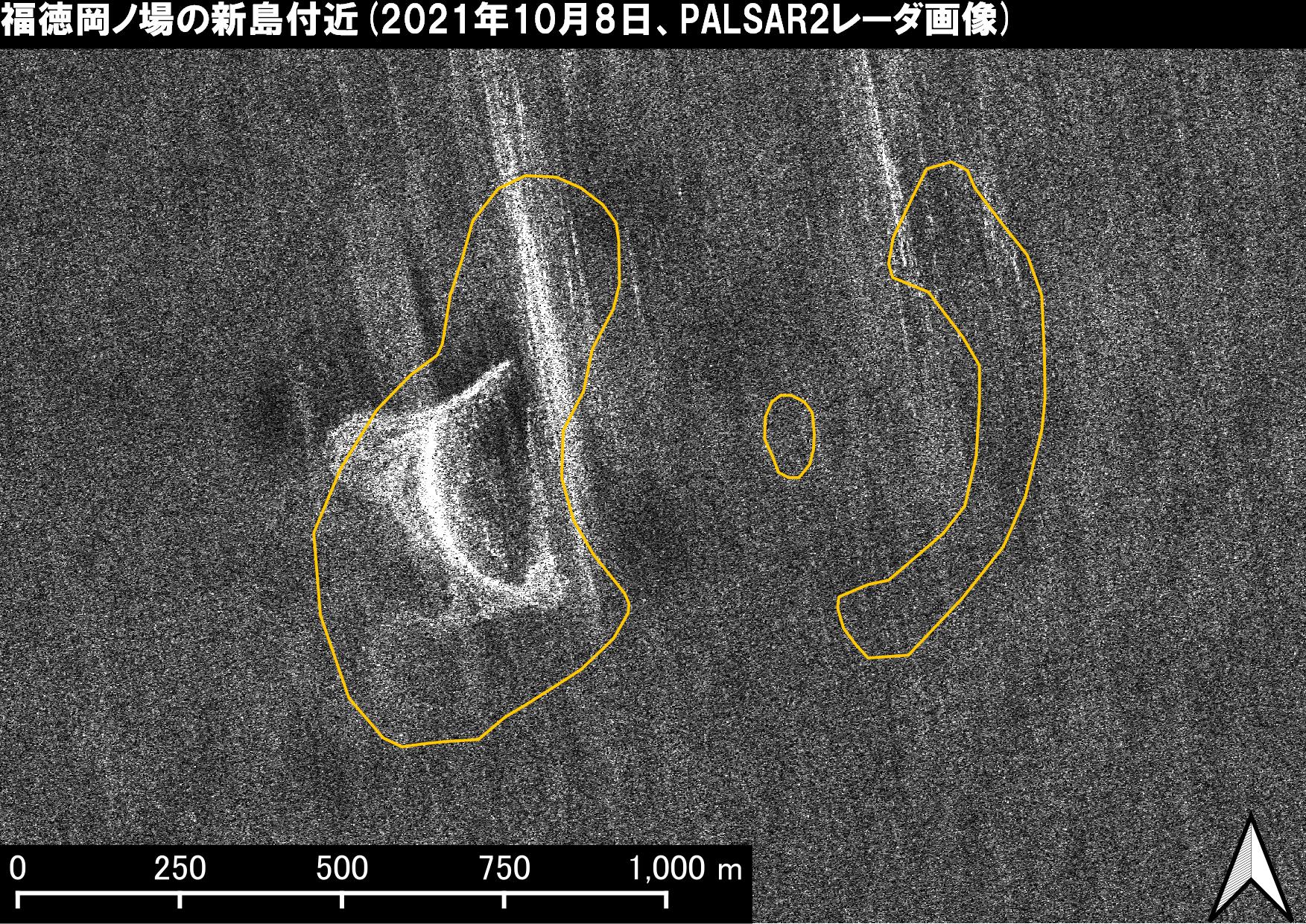 October 8 |
·Landsat 8: The north end and southwestern coastline of the western new island has receded and the island became smaller. Same as the observation on September 18, what appears to be foaming waves could be observed at the location of the eastern new island. ·ALOS-2: The western island became much smaller, but it continues to exist. |
■Discolored seawater
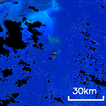
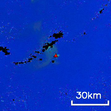
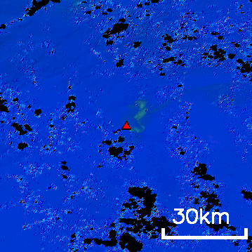
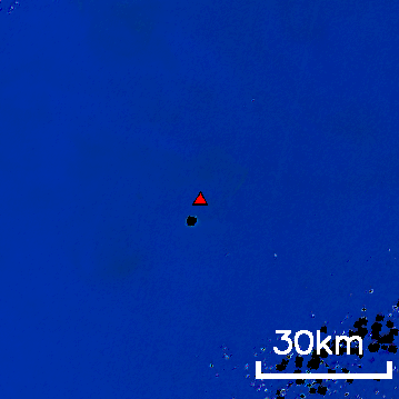
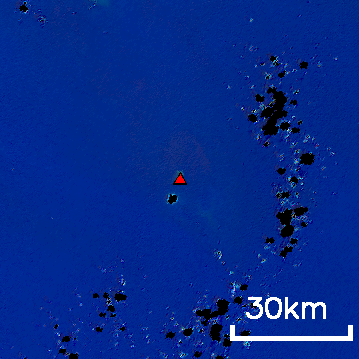
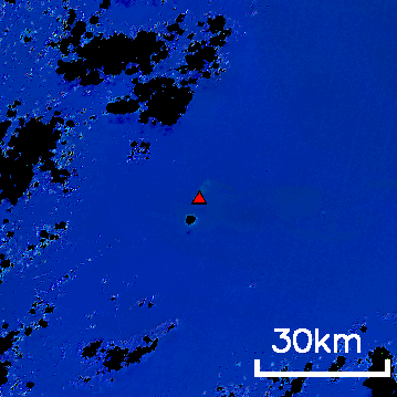
Discolored seawater is a phenomenon in which seawater is discolored by volcanic activity. It can be used as an indicator for the activity of volcanoes in the oceans. As of September 27, discolored water still can be seen at Fukutoku-Oka-no-Ba, which erupted on August 13. Figures 5 and 6 show the observation results from GCOM-C. Revolving around the earth, GCOM-C continuously observes Earth surface. It can observe around Fukutoku-Oka-no-Ba once every two days in average with a resolution of 250 m. Since GCOM-C is capable of observing ocean color correctly, we can understand the volcanic activity status from the image of discolored seawater observed by GCOM-C (Normally, ocean color is blue. We can find discolored seawater as green around Fukutoku-Oka-no-Ba).The image of discolored seawater (Fig. 6) shows that volcanic activity at Fukutoku-Oka-no-Ba has likely increased since around February or March 2021. While JCG was paying close attention to the activity, the eruption occurred. JAXA will continue to monitor the occurrence and the scale of discolored seawater and provide the information to relevant organizations including JCG and JMA.
| August 17 (Discolored seawater about 120 km to the northwest) |
September 1 (Discolored seawater about 70 km to the northwest) |
September 17 (Discolored seawater about 20 km to the northeast) |
 |
 |
 |
(Ocean color image by GCOM-C, the red triangle indicates the location of Fukutoku-Oka-no-Ba, black parts are missing data caused by clouds etc.)
| December 15, 2020 (No discolored seawater) |
February 16 (Discolored seawater about 2 km to the north) |
March 8 (Discolored seawater about 8 km to the north) |
 |
 |
 |
(Ocean color image by GCOM-C, the red triangle indicates the location of Fukutoku-Oka-no-Ba, black parts are missing data caused by clouds etc.)
■Pumice stones
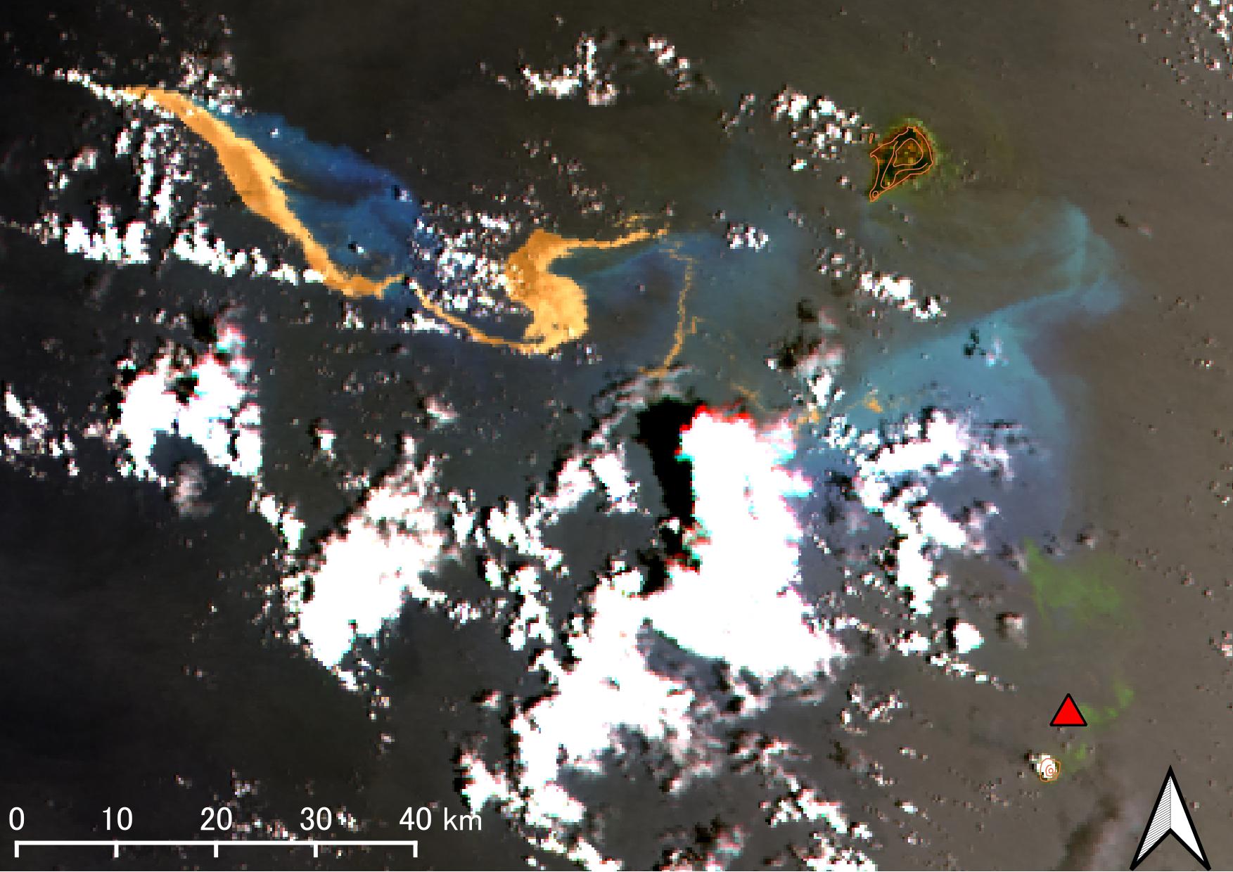
Due to the Plinian eruption, a large amount of pumice stones was also produced this time. Pumice stones keep floating on the sea surface for a while, preventing vessels from navigation. As of September 27, GCOM-C observed pumice stones floating about 850 km to the northwest of Fukutoku-Oka-no-Ba. Four days after the eruption, areas which appears to be brown in the upper left of the GCOM-C visible image (a color image like a camera shot) in Figure 7 are rafts made of pumice stones. When viewed in conjunction with the daytime thermal infrared image (the brighter colors indicate warmer temperatures), we could identify the parts as pumice stones. Pumice stones are seen bright (warmer) in thermal infrared image because they are warmed by the sun and become warmer than the sea surface.
| Visible image on August 17 (Brownish parts in the upper left indicate pumice stones) |
Thermal infrared image on August 17 (White, high temperature parts indicate pumice stones) |
 |
|
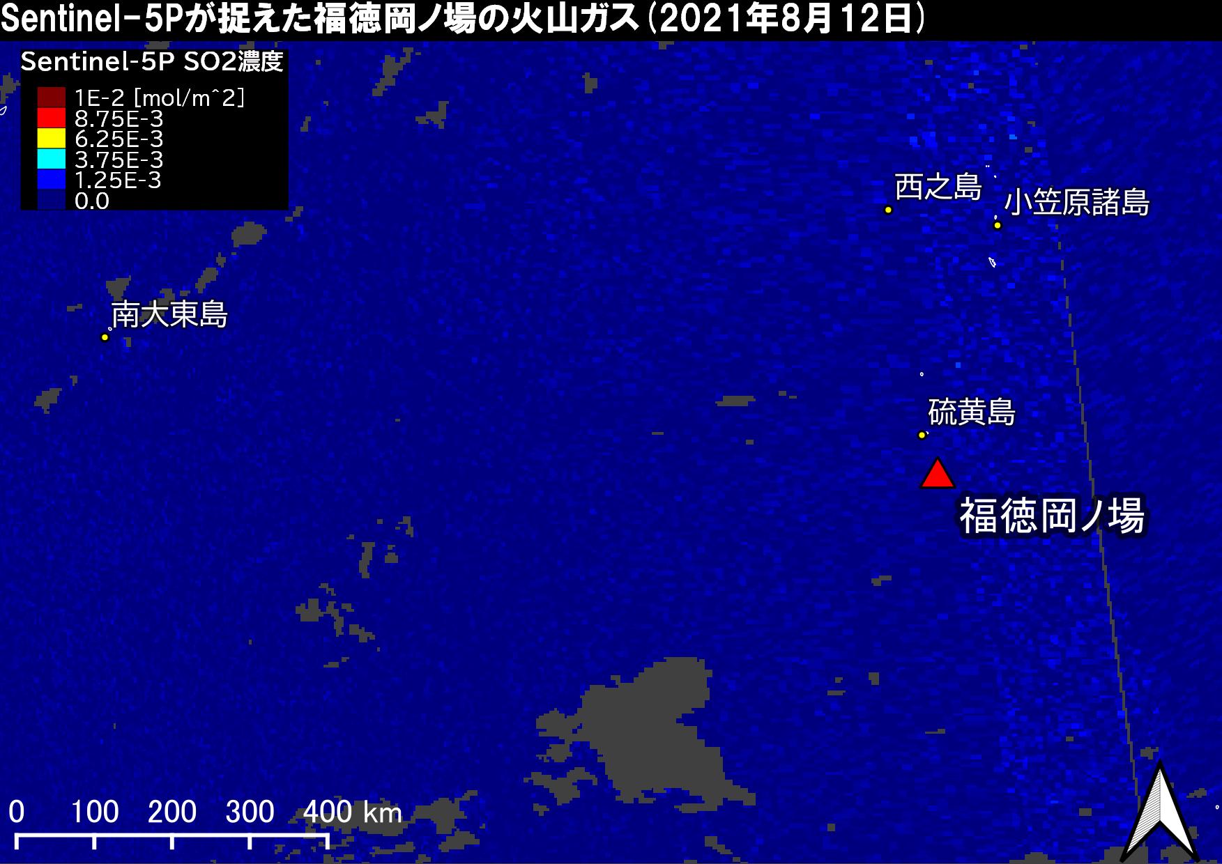
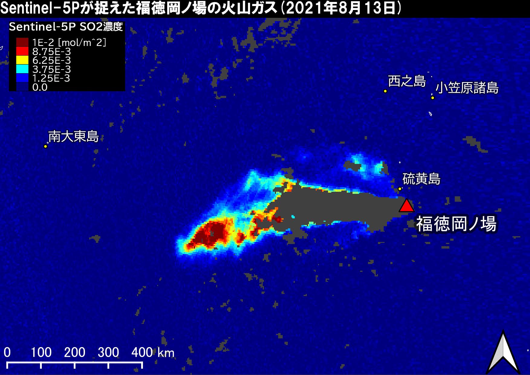
■Sulfur dioxide (SO2) and plumes
Gases emitted by volcanic activity, such as sulfur dioxide (SO2) and plumes can also be observed by the satellites. Following is an observation example of plumes captured by the JMA’s geostationary meteorological satellite “Himawari-8” and SO2 captured by the ESA’s Earth observation satellite “Sentinel-5P.” Figure 8 is the moving image which shows a series of “Himawari” visible images (every 10 minutes) from August 12, pre-eruption to August 14. We can see that the plume is rising from the same spot and gradually spreading to the west. Also, SO2 was identified by the Sentinel-5P observation result on August 13, the day of eruption and August 14 (Fig. 9) but has not been detected since then.
| August 12 (pre-eruption) | August 13 (the day of eruption) | August 14 |
 |
 |
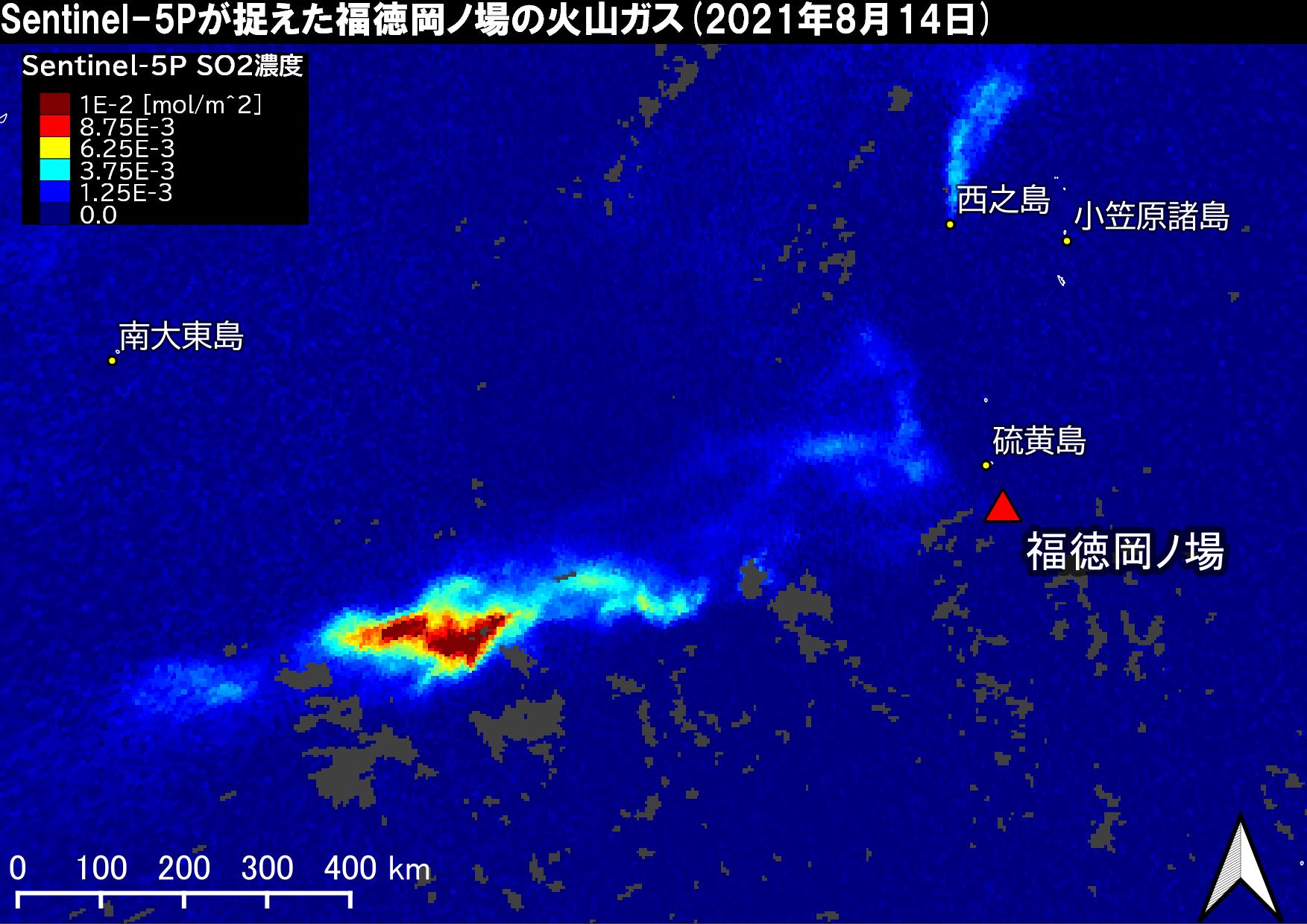 |
Figure 9: Change of Sulfur dioxide (Sentinel-5P, the red triangle indicates the location of Fukutoku-Oka-no-Ba)
|
■Comment from the Japan Coast Guard The Japan Coast Guard conducts monitoring and observation of volcanoes in the oceans by aircraft and survey vessel for the purpose of the safety of marine traffic and securing the interests of territory and territorial seas due to the creation of new islands. Unfortunately, it is difficult to observe remote volcanoes in the oceans by aircraft, including Fukutoku-Oka-no-Ba. Therefore, we have utilized data obtained from satellites of JAXA and other agencies for monitoring. The data are important to complement aerial observations. |
|
■Comment from Prof. Kenji Nogami, Tokyo Institute of Technology: Since increased activity of volcanoes in the oceans affects marine traffic, it is very important to monitor and observe volcanic activities. Also, widespread volcanic gases and plumes greatly influence air traffic. Detailed information on volcanic activities in the oceans by satellite observation is highly useful not only for disaster prevention but also for national interests, and is expected to play an increasingly important role. |
■JAXA Volcano monitoring system (under research)
・JAXA Volcano monitoring system (English page available)
Utilizing visible and infrared image from GCOM-C, CIRC and others, it is possible to monitor remote volcano activities frequently. JAXA is working on research together with external agencies and providing satellite data to disaster prevention agencies aiming for contribution to disaster prevention and mitigation in the future. As a part of these efforts, we release the analysis results of infrared data and others for volcanoes around Japan through “JAXA Volcano monitoring system.”
■Related Sites
JAXA Himawari Monitor : You can view the ash plumes shown in Figure 8. The site releases the geostationary satellite Himawari Standard Data provided by JMA as well as the geophysical parameter data produced by JAXA using the Himawari Standard Data.
Japan Coast Guard:Fukutoku-Oka-no-Ba (ocean database) (in Japanese)
Japan Meteorological Agency: Fukutoku-Oka-no-Ba
Geospatial Information Authority of Japan: Information on eruption activity at Fukutoku-Oka-no-Ba (in Japanese)
Tokyo Institute of Technology, School of Science, Volcanic Fluid Research Center
Search by Year
Search by Categories


Tags
-
#Earthquake
-
#Land
-
#Satellite Data
-
#Aerosol
-
#Public Health
-
#GCOM-C
-
#Sea
-
#Atmosphere
-
#Ice
-
#Today's Earth
-
#Flood
-
#Water Cycle
-
#AW3D
-
#G-Portal
-
#EarthCARE
-
#Volcano
-
#Agriculture
-
#Himawari
-
#GHG
-
#GPM
-
#GOSAT
-
#Simulation
-
#GCOM-W
-
#Drought
-
#Fire
-
#Forest
-
#Cooperation
-
#Precipitation
-
#Typhoon
-
#DPR
-
#NEXRA
-
#ALOS
-
#GSMaP
-
#Climate Change
-
#Carbon Cycle
-
#API
-
#Humanities Sociology
-
#AMSR
-
#Land Use Land Cover
-
#Environmental issues
-
#Quick Report
-
#GOSAT-GW
Related Resources


Disaster Related Articles
-
 Disaster 2025.10.23 Thu ALOS-2 Observations of the Earthquakes in the Philippines
(Cebu Island and Mindanao Island) -
 Disaster 2025.04.04 Fri ALOS-2 Observation of the M7.7 Earthquake in Myanmar
 -
 Disaster 2024.09.09 Mon ALOS-2 Observation of the Oil Spill Caused by the Sinking of a Tanker in Manila Bay, Philippines
 -
 Disaster 2023.04.07 Fri ALOS-2 observation: Oil spill from sunken oil tanker off Mindoro Island, Philippines (follow-up report)
Stay Connected
