
Latest Observation
2011.03.02 Wed
Fire Country: Kumamoto, Japan
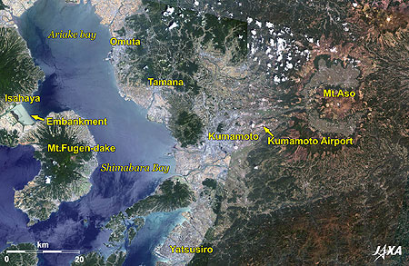
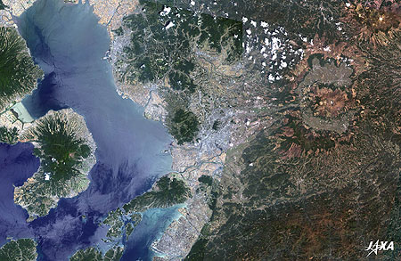
Figure 1 is a composite image of Kumamoto, Japan and its vicinity as observed by ALOS (“Daichi”) in April 2010 (right-hand side) and June 2010 (left-hand side). The bluish-gray area in the center of the image is Kumamoto. Two active volcanoes, Mt. Aso in the east and Mt. Fugen-dake at Unzen in the west, look like they are converging on the city, giving Kumamoto the name “Fire Country.” The Kyushu Shinkansen (bullet train) connects Yatsushiro (seen at the bottom), Tamana, Omuta, and Hakata further north (not visible).
The bright light blue area at the left center is a balancing reservoir made by the Isahaya Bay Reclamation Project. The colors of the water on both sides of the embankment in the bay are greatly different.
caption on
caption off
Fig. 2. Enlarged Image of Kumamoto
Kumamoto (kmz, 5.02 MB, Low Resolution) as seen on Google Earth.
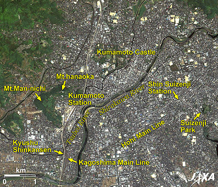
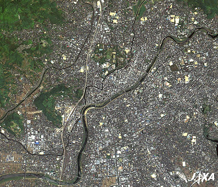
Figure 2 is an enlarged image of the urban area of Kumamoto. The railway track of the Kyushu Shinkansen, which opened for service on March 12, is visible as a white vertical line. The conventional JR (Japan Railways) Kagoshima Main Line runs beside the Kyushu Shinkansen. Mountains (Mt. Hanaoka and Mt. Man-nichi) and rivers (Shirakawa River and Tsuboi River) surround Kumamoto Station. The area is under development in accordance with the opening of the Kyushu Shinkansen.
Kumamoto Castle and the downtown area are located to the northeast of Kumamoto Station. Tramcar service is available from Kumamoto Station to the downtown area, Kumamoto Castle, and Shin (New) Suizenji Station of the JR Hohi Main Line.
The Kyushu Shinkansen
The Kyushu Shinkansen was already in service between Kagoshima Central Station and Shin Yachiyo Station in Kumamoto. With service opening between Shin Yachiyo and Hakata (130 km total) as of March 12, development of the Kyushu Shinkansen (Kagoshima route) between Kagoshima Central Station and Hakata Station is complete. As a result, the Kyushu Shinkansen now carries out service across the entire line, which connects Kumamoto to Hakata in 33 minutes and to Kagoshima in 44 minutes at its swiftest. Mutual roll up of trains between the Kyushu Shinkansen and the Sanyo (mid-western area of Japan’s main island) Shinkansen is also planned.
Kumamoto Castle
Famous warlord Kiyomasa Kato completed Kumamoto Castle in 1607 after 7 years of labor. It is one of three renowned castles in Japan. After the banning of the second lord, Tadahiro Kato, Tadatoshi Hosokawa entered the castle as the first local lord of the Higo-Kumamoto Domain. Kumamoto then became the center of the domain and Hosokawa’s family flourished for 239 years and 11 generations, occupying a 540,000-goku* feudality.
A typical feature of Kumamoto Castle is the stone walls called “returned warrior,” which were built to prevent enemy invasions. The stone walls, which arc inward and upward, were built using a special technique by masons called the “Anou Group” of Omi (present Shiga Prefecture) that Kiyomasa brought with him. Two hundred and fifty years later, its value was proven at the Satsuma Rebellion (otherwise called the Southwestern War) in 1877. The Satsuma Army was repelled by the wall and no one was able to enter the castle.
Although the main buildings were burned down by this rebellion, restoration of the castle has continued for many years.
*Goku (or Koku) is a unit to measure the weight of rice grains. One goku is about 143 kg, which is equivalent to the amount of rice that one man eats per year, and requires a rice field area of 990 m2 to produce it. Thus, the goku unit is also used to express the extent of the feudality that produces that amount of rice.
Suizenji Park
While Tadatoshi Hosokawa was on a falconry excursion, he was charmed by a place where clear water was upwelling, and he built a teahouse there. A large-scale garden was landscaped by the third lord Tsunatoshi, and a graceful circuit-style garden of the Momoyama period was completed. With a pond made from the spring water of Aso at its center and representing 53 stations along the Tokaido (the route between Edo (Tokyo) and Kyoto), the garden has been designated as a national scenic and historic place.
caption on
caption off
Fig. 3. Enlarged Image of Mt. Aso
Mt. Aso (kmz, 4.73 MB, Low Resolution) as seen on Google Earth.
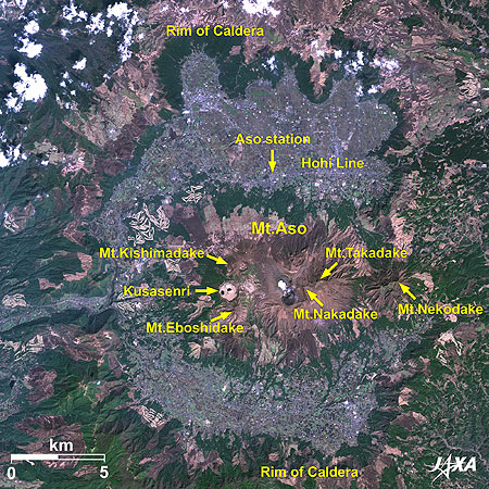
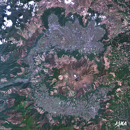
Figure 3 is an enlarged image of Mt. Aso, the rim of the caldera spreading across the whole area of the image. This is one of the largest calderas in the world (17 km east to west, 25 km north to south, with an area of 350 km2). The five central peaks of Aso**, including Mt. Nakadake, are visible inside. The crater (400 m east to west and 1,100 m north to south) west of Mt. Nakadake is still smoking. An aerial tramway service is available to the crater’s rim, where passengers can watch a smoking fumarole up close.
The light brown area at the left side of the crater is a grass field called Kusasenri, where cattle graze from spring to autumn.
**The five central peaks are Mt. Nakadake (1,506 m), Mt. Takadake (1,592 m), Mt. Nekodake (1,408 m), Mt. Kishimadake (1,321 m), and Mt. Eboshidake (1,337 m).
With full-service operation of the Kyushu Shinkansen, access to Kumamoto becomes much easier than before. An increasing number of visitors to the great castle and wild nature are expected.
Reference Sites:
Explanation of the Images:

| Satellite: | Advanced Land Observing Satellite (ALOS) (Daichi) |
| Sensor: |
Advanced Visible and Near Infrared Radiometer-2 (AVNIR-2) Panchromatic Remote-sensing Instrument for Stereo Mapping (PRISM) |
| Date: |
0110 (UTC) on June 5, 2010 (Simultaneous Observation of AVNIR-2 and PRISM) (Fig. 2 and 3) 0109 (UTC) on April 3, 2010 (Simultaneous Observation of AVNIR-2 and PRISM) (Fig. 1 and 3) |
| Ground resolution: | 10 m (AVNIR-2) and 2.5 m (PRISM) |
| Map Projection: | Universal Transversal Mercator (UTM) |
AVNIR-2 has four observation bands. The color composite images are produced by assigning red to Band 3 (610 to 690 nm), green to Band 2 (520 to 600 nm), and blue to Band 1 (420 to 500 nm). The resulting images have natural coloring as if seen by the naked eye. Each color indicates the following ground objects:
| Deep green: | Forests |
| Light green: | Grass fields or farmlands |
| Dark green: | Paddy fields |
| Bluish-gray: | Urban area |
| Brown: | Bare land |
| Blue: | Water surface |
| White: | Buildings or clouds |
(Fig. 2 and 3)
PRISM is an optical sensor for observing ground surfaces with visible and near-infrared signals in the 520- to 770-nanometer (one-billionth of a meter) band. The image is monochromatic but has a higher resolution. PRISM has three independent optical systems to acquire images in the view of nadir, forward, and backward simultaneously. Only the nadir images are used in the images.
The above AVNIR-2 color composite image is decomposed into hue, saturation, and intensity. The intensity portion is replaced by PRISM data. The hue, saturation, and intensity data are then reversed into a color image. This color image has a virtual 2.5-m resolution. A color image composed by combining a higher resolution monochromatic image and a lower resolution color image is called a pan-sharpened image.
Related Sites
Search by Year
Search by Categories
Tags
-
#Earthquake
-
#Land
-
#Satellite Data
-
#Aerosol
-
#Public Health
-
#GCOM-C
-
#Sea
-
#Atmosphere
-
#Ice
-
#Today's Earth
-
#Flood
-
#Water Cycle
-
#AW3D
-
#G-Portal
-
#EarthCARE
-
#Volcano
-
#Agriculture
-
#Himawari
-
#GHG
-
#GPM
-
#GOSAT
-
#Simulation
-
#GCOM-W
-
#Drought
-
#Fire
-
#Forest
-
#Cooperation
-
#Precipitation
-
#Typhoon
-
#DPR
-
#NEXRA
-
#ALOS
-
#GSMaP
-
#Climate Change
-
#Carbon Cycle
-
#API
-
#Humanities Sociology
-
#AMSR
-
#Land Use Land Cover
-
#Environmental issues
-
#Quick Report
Related Resources
Related Tags
Latest Observation Related Articles
-
 Latest Observation 2025.12.03 Wed [Quick Report] Analysis results from satellite precipitation data on the record-breaking heavy rainfall occurring in Southeast Asia in late November 2025
 -
 Latest Observation 2025.10.01 Wed [Quick Report] Hurricane Humberto “Eye” captured by EarthCARE satellite (Hakuryu)
 -
 Latest Observation 2025.02.28 Fri The world’s largest iceberg, A23a, may have run aground on the continental shelf of South Georgia:
The trajectory of iceberg A23a observed by “GCOM-W”, “ALOS-2” and “ALOS-4” -
 Latest Observation 2024.11.06 Wed [Quick Report] Heavy rainfalls in eastern Spain, as seen by the Global Satellite Mapping of Precipitation (GSMaP)


