


Research and Development
2021.12.14 Tue
Announcement of the launch of the AMSR Series website
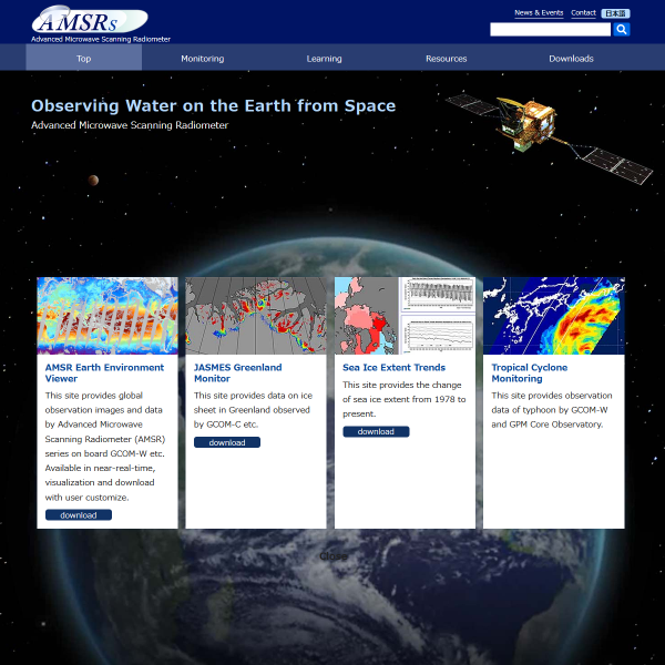
The Earth Observation Research Center (EORC) is pleased to announce the launch of a new integrated website for research and application using JAXA’s Advanced Microwave Scanning Radiometer (AMSR) series. This website provides basic knowledge about the AMSR series, a viewer that allows easy viewing of observation data, and explanations of the AMSR data, by integrating information distributed in the individual satellite mission’s website. Information for researchers will also be provided on this website.
The ASMR Series Website at Earth Observation Research Center
https://www.eorc.jaxa.jp/AMSR/
1. Overview of AMSR series
The AMSR series consists of the ADEOS-II/AMSR and Aqua/AMSR-E (mission completed), the GCOM-W/AMSR2 (currently in operation), and the GOSAT-GW/AMSR3 (scheduled to be launched in Japanese Fiscal Year of 2023). The AMSR is a satellite sensor that observes microwave signals naturally emitted from various materials on the earth. These signals enable us to estimate various geophysical quantities related to the water cycle based on the characteristics of microwaves. The AMSR is observable day and night, covering more than 99% of the earth’s surface in just two days. Utilizing its wide area and high frequency observation, it is used in diverse fields, such as weather forecasting, surveying fishing grounds, climate change, and water cycle research.
2. Examples of web content
The website integrates information distributed in the existing websites of each satellite mission and provides basic knowledge of the AMSR series, application examples, data browsing services such as AMSR Viewer, and explanations of data products required for use. We will continue to improve the contents toward the launch of AMSR3.
2.1 AMSR Earth Environment Viewer (AMSR Viewer)
https://www.eorc.jaxa.jp/AMSR/viewer/
( June 30, 2020 Pre-release )
The AMSR Viewer is a system for displaying global earth observation data obtained from the Advanced Microwave Scanning Radiometer (AMSR) series, which consists of the GCOM-W/AMSR2 and the Aqua/AMSR-E. The AMSR Viewer has provided daily images of observed brightness temperature and estimated geophysical data since June 2002.
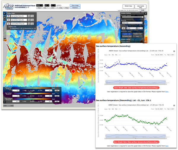
| Image layer | Multiple images can be superposed on map (Max. 3 layers). |
| Color scale | Maximum and minimum values can be customized. |
| Map image | A displayed map image can be saved as PNG file. |
| Time-series graph | A time-series graph at any point on map can be created and be saved as image file Graph data is available for registered users. |
| Slide show | Consecutive frame images for 14 days can be automatically replayed. |
| Auxiliary information | Basemap Satellite image or maps can be displayed as background. Cloud image Cloud image (hourly) can be superposed. Geographical information Coastlines, rivers channels, and grid lines (0.5dgree) |
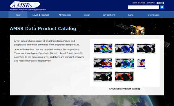
2.2 AMSR Data Product Catalog
http://www.eorc.jaxa.jp/AMSR/datacatalog/
AMSR products include brightness temperature, which is observed data, and geophysical parameters estimated from brightness temperature. AMSR Data Product Catalog provides an overview of various data products, calibration and validation results.
Search by Year
Search by Categories


Tags
-
#Earthquake
-
#Land
-
#Satellite Data
-
#Aerosol
-
#Public Health
-
#GCOM-C
-
#Sea
-
#Atmosphere
-
#Ice
-
#Today's Earth
-
#Flood
-
#Water Cycle
-
#AW3D
-
#G-Portal
-
#EarthCARE
-
#Volcano
-
#Agriculture
-
#Himawari
-
#GHG
-
#GPM
-
#GOSAT
-
#Simulation
-
#GCOM-W
-
#Drought
-
#Fire
-
#Forest
-
#Cooperation
-
#Precipitation
-
#Typhoon
-
#DPR
-
#NEXRA
-
#ALOS
-
#GSMaP
-
#Climate Change
-
#Carbon Cycle
-
#API
-
#Humanities Sociology
-
#AMSR
-
#Land Use Land Cover
-
#Environmental issues
-
#Quick Report
-
#GOSAT-GW
Related Resources


Related Tags
Research and Development Related Articles
-
 Research and Development 2026.03.09 Mon High-Resolution Predictions of Global Terrestrial Water Cycle:
Today’s Earth – Global Updated -
 Research and Development 2025.06.18 Wed Advancing Space-Based Weather Analysis and Forecasting – Renewal of JAXA’s Realtime Weather Watch ‘NEXRA3’ and Performance Evaluation with the previous system (Overview Article)
 -
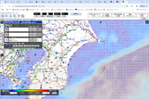 Research and Development 2025.03.27 Thu Launch of Ocean Weather Forecasts 1km resolution
 -
 Research and Development 2024.05.27 Mon The Use of Earth Observation Satellite Data in the Humanities and Social Sciences (3)
Stay Connected
