


Research and Development
2018.05.17 Thu
Release of Today’s Earth – Global (TE-Global)
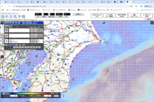
The Earth Observation Research Center (EORC) of Japan Aerospace Exploration Agency (JAXA) has released a new webpage “Today’s Earth – Global” (TE-Global), which visualizes and distributes Global hydrological simulation results (Figure 1). The TE-Global system was developed with the assistance of the University of Tokyo and utilizes the Japan Meteorological Agency long-term reanalysis data and satellite observation data, which is provided by JAXA, such as Global Satellite Mapping of Precipitation (GSMaP).
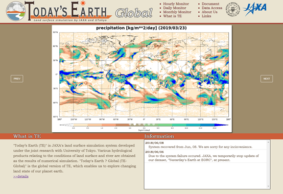
Figure 1. An image of TE-Global website top page
The webpage provides access to over 50 hydrological variables calculated by a land surface model (MATSIRO5) and river routing model (CaMa-Flood) from 1958 to the present. The accuracy of essential variables (e.g., snow depth, soil moisture, river discharge, and inundation area) has been confirmed by comparing in-situ observation data or satellite observation data.
For example, Figure 2 shows the severity index for river discharge, termed “return period,” calculated by the TE-Global system in the case of Hurricane Harvey at the end of August, 2017. The TE-Global system efficiently shows the severity of the situation by describing the increase in the number of reddish grids indicating “very severe” (return period of over 30 years) as the hurricane passes over Houston, Texas. Therefore, through the TE-Global website, the severity of the situation can be seen in comparison with the usual and past state.
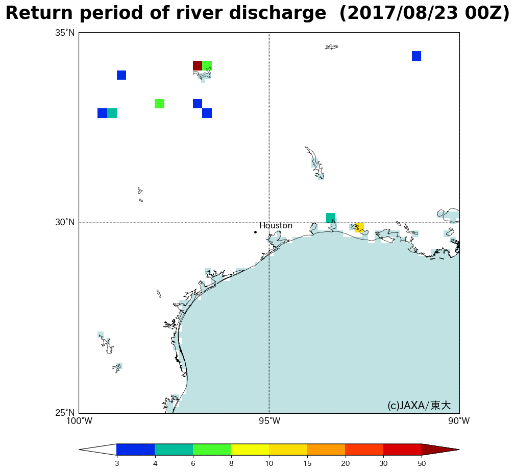
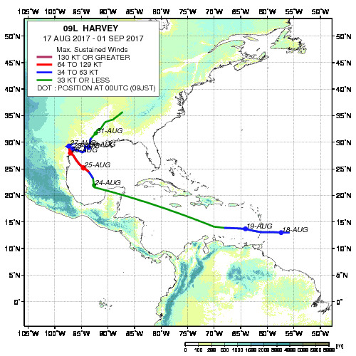
Figure 2. Map plotting track of the Hurricane Harvey (right figure) and distribution of return period for river discharge calculated by TE-Global in the period of August 23rd to September 4th, 2017 (left figure).
Related Sites
Search by Year
Search by Categories


Tags
-
#Earthquake
-
#Land
-
#Satellite Data
-
#Aerosol
-
#Public Health
-
#GCOM-C
-
#Sea
-
#Atmosphere
-
#Ice
-
#Today's Earth
-
#Flood
-
#Water Cycle
-
#AW3D
-
#G-Portal
-
#EarthCARE
-
#Volcano
-
#Agriculture
-
#Himawari
-
#GHG
-
#GPM
-
#GOSAT
-
#Simulation
-
#GCOM-W
-
#Drought
-
#Fire
-
#Forest
-
#Cooperation
-
#Precipitation
-
#Typhoon
-
#DPR
-
#NEXRA
-
#ALOS
-
#GSMaP
-
#Climate Change
-
#Carbon Cycle
-
#API
-
#Humanities Sociology
-
#AMSR
-
#Land Use Land Cover
-
#Environmental issues
-
#Quick Report
-
#GOSAT-GW
Related Resources


Related Tags
Research and Development Related Articles
-
 Research and Development 2026.03.09 Mon High-Resolution Predictions of Global Terrestrial Water Cycle:
Today’s Earth – Global Updated -
 Research and Development 2025.06.18 Wed Advancing Space-Based Weather Analysis and Forecasting – Renewal of JAXA’s Realtime Weather Watch ‘NEXRA3’ and Performance Evaluation with the previous system (Overview Article)
 -
 Research and Development 2025.03.27 Thu Launch of Ocean Weather Forecasts 1km resolution
 -
 Research and Development 2024.05.27 Mon The Use of Earth Observation Satellite Data in the Humanities and Social Sciences (3)
Stay Connected
