“JICA-JAXA Forest Early Warning System in the Tropics (JJ-FAST)”


Research and Development
2016.11.14 Mon
Release of JICA-JAXA Forest Early Warning System in the Tropics (JJ-FAST)

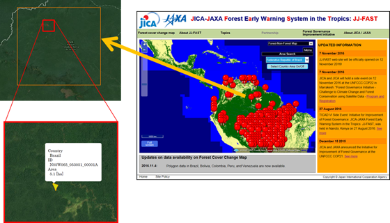
Between 2009 and 2012, JICA and JAXA supported the monitoring of illegal logging in the Amazon Basin of Brazil in near-real time using observation data from ALOS, the predecessor to ALOS-2. The ability of ALOS to penetrate clouds made it possible to constantly monitor tropical forests during the rainy season. More than 2,000 incidents of illegal logging were detected by ALOS in Brazil, which greatly contributed to a 40 percent reduction in illegal logging areas.
Building on the knowledge obtained through these efforts, JICA and JAXA then agreed to monitor deforestation and forest changes in tropical regions around the world using data from ALOS-2, and announced the “Initiative for Improvement of Forest Governance” at the Japan pavilion of the twenty-first session of the Conference of the Parties (COP21) to the United Nations Framework Convention on Climate Change (UNFCCC) in Paris in 2015.*
JJ-FAST was established as part of this initiative, and will provide the latest information on deforestation and forest changes in tropical regions globally, on an average of once every 45 days. JJ-FAST can be accessed by anyone anywhere under an environment capable of connecting to the Internet.
When the service begins, the data for five countries in Latin America will be released. The target area will expand gradually to African and Asian regions. The final goal for JJ-FAST is to release monitoring data of approximately 60 countries that have tropical forests. The detection accuracy of deforestation in JJ-FAST will be improved according to user feedback.
Because of its ability to monitor vast forest areas from space, JJ-FAST can be an effective means to monitor forests for developing countries that have problems doing so due to inadequate infrastructure, public security issues, a shortage of qualified personnel or budgetary issues. JICA and JAXA support sustainable forest management for developing countries through the spread of JJ-FAST, and are dedicated to reducing deforestation with the long-term aim of mitigating climate change.
Going forward, JICA and JAXA will continue to put forth efforts in resolving challenges that developing countries face and global problems through the use of space technologies.
Search by Year
Search by Categories
Tags
-
#Earthquake
-
#Land
-
#Satellite Data
-
#Aerosol
-
#Public Health
-
#GCOM-C
-
#Sea
-
#Atmosphere
-
#Ice
-
#Today's Earth
-
#Flood
-
#Water Cycle
-
#AW3D
-
#G-Portal
-
#EarthCARE
-
#Volcano
-
#Agriculture
-
#Himawari
-
#GHG
-
#GPM
-
#GOSAT
-
#Simulation
-
#GCOM-W
-
#Drought
-
#Fire
-
#Forest
-
#Cooperation
-
#Precipitation
-
#Typhoon
-
#DPR
-
#NEXRA
-
#ALOS
-
#GSMaP
-
#Climate Change
-
#Carbon Cycle
-
#API
-
#Humanities Sociology
-
#AMSR
-
#Land Use Land Cover
-
#Environmental issues
-
#Quick Report
Related Resources
Related Tags
Research and Development Related Articles
-
 Research and Development 2025.06.18 Wed Advancing Space-Based Weather Analysis and Forecasting – Renewal of JAXA’s Realtime Weather Watch ‘NEXRA3’ and Performance Evaluation with the previous system (Overview Article)
 -
 Research and Development 2025.03.27 Thu Launch of Ocean Weather Forecasts 1km resolution
 -
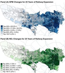 Research and Development 2024.05.27 Mon The Use of Earth Observation Satellite Data in the Humanities and Social Sciences (3)
 -
 Research and Development 2024.03.06 Wed High sea surface temperatures in the Sea of Japan in relation to Typhoon No. 7, the only typhoon to hit Japan in 2023


