


Applications
2023.07.10 Mon
Contribution to SDGs Goal 15 “Life on Land”
SDGs Goal 15 “Life on Land” aims to protect and restore various ecosystems on land, including sustainable forest management, combating desertification, and halting land degradation, and this goal includes 12 targets. Among them, Target 15.4 has been set for mountains, which states “By 2030, ensure the conservation of mountain ecosystems, including their biodiversity, in order to enhance their capacity to provide benefits that are essential for sustainable development”.
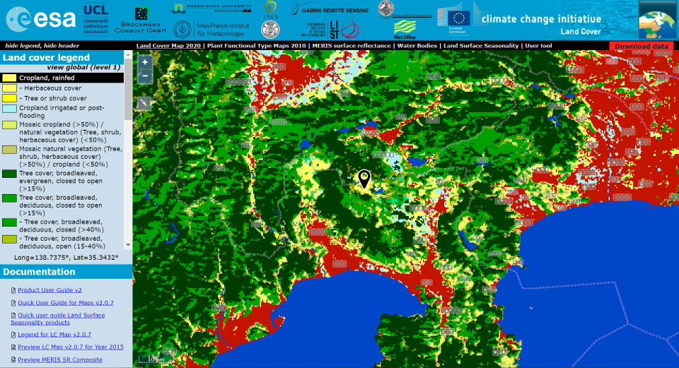
One of the indicators that measure progress on this target is the Mountain Green Cover Index (MGCI) as Indicator 15.4.2, which is the proportion of green cover in the mountains. Since mountain areas can be classified by elevation and slope, the green cover is calculated for each of these categories. The custodian agency is the Food and Agriculture Organization of the United Nations (FAO), which cites global land cover maps produced from satellite data by the European Space Agency (ESA) as one of the data sources for calculating MGCI. In 2020, FAO itself calculated the MGCI for each country and asked the countries to verify it.
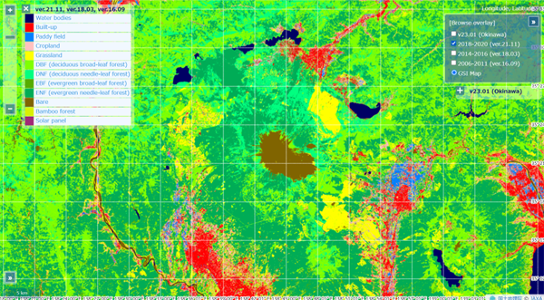
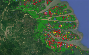
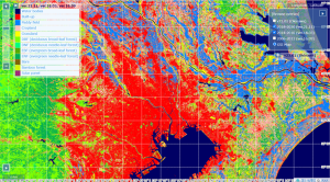
In response to this request, the calculation and verification of Japan’s MGCI was conducted at the “Council for Industry-Government-Academia Consultations on the Promotion of the Use of Big Data” under the Ministry of Internal Affairs and Communications. FAO has presented the necessary data and methodology for the calculation, but recommends that each country use its own data for mountains and vegetation if available, as conditions vary from country to country. Since Japan has “High-Resolution Land Use and Land Cover Map Products” created by JAXA using satellite observation images, this data was used for the MGCI calculations.
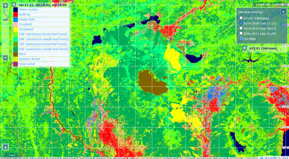
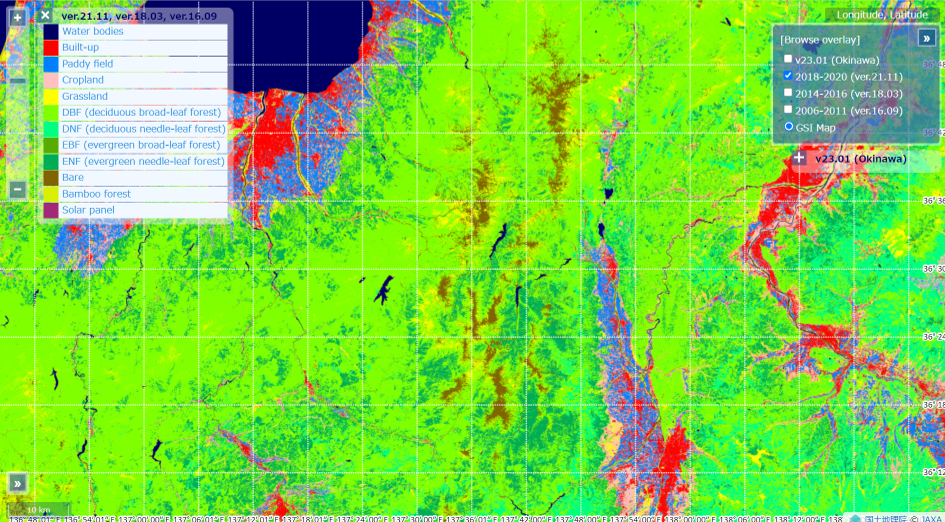
The calculation results show that the MGCI is more than 1% lower in total than the FAO calculation results. The JAXA land cover map has a higher resolution than that of the ESA and classifies the land according to the actual conditions in Japan, which improved the accuracy of the MGCI. It is assumed that the FAO values overestimated the Japanese MGCI. Since the objective of Target 15.4 is to protect mountain ecosystems including biodiversity, improving the accuracy of the MGCI will enable us to more accurately assess the situation and protect it appropriately. On the other hand, JAXA’s land cover map does not cover the entire globe, and countries that do not have their own data need ESA’s land cover map.
Japan’s MGCI values calculated by JAXA can be found on the JAPAN SDGs Action Platform, along with its calculation method. In addition, the “SDGs Geospatial Roadmap” website created by the UN Inter-Agency Expert Group on SDG Indicators (IAEG-SDGS) introduces “Japan’s National Experience in Producing SDG15.4.2,” along with the Green Non-Green Map created based on Japan’s mountains classification map as well as JAXA’s land cover map.
Search by Year
Search by Categories


Tags
-
#Earthquake
-
#Land
-
#Satellite Data
-
#Aerosol
-
#Public Health
-
#GCOM-C
-
#Sea
-
#Atmosphere
-
#Ice
-
#Today's Earth
-
#Flood
-
#Water Cycle
-
#AW3D
-
#G-Portal
-
#EarthCARE
-
#Volcano
-
#Agriculture
-
#Himawari
-
#GHG
-
#GPM
-
#GOSAT
-
#Simulation
-
#GCOM-W
-
#Drought
-
#Fire
-
#Forest
-
#Cooperation
-
#Precipitation
-
#Typhoon
-
#DPR
-
#NEXRA
-
#ALOS
-
#GSMaP
-
#Climate Change
-
#Carbon Cycle
-
#API
-
#Humanities Sociology
-
#AMSR
-
#Land Use Land Cover
-
#Environmental issues
-
#Quick Report
-
#GOSAT-GW
Related Resources


Related Tags
Applications Related Articles
-
 Applications 2024.01.15 Mon The Use of Earth Observation Satellite Data in the Humanities and Social Sciences (2)
 -
 Applications 2023.11.29 Wed The Use of Earth Observation Satellite Data in the Humanities and Social Sciences (1)
 -
 Applications 2023.08.04 Fri Contribution to SDGs Goal 6 “Clean Water and Sanitation”
 -
 Applications 2023.06.15 Thu Contribution to SDGs Goal 11 “Sustainable cities and communities”
Stay Connected
