


Contributions to Sustainable Development Goals
where no one is left behind, by challenging to solve the world’s issues through technological innovation and cooperation with various stakeholders. In order to achieve the SDGs, it is necessary to objectively understand what is happening on the Earth and how we are dealing with it. Earth observation satellites can provide clear and global views of land, oceans, water, atmosphere, and human activities from space. We believe that the satellite data and information are the scientific evidence that guide us to better decision-making and make appropriate actions to achieve the SDGs.
What is the SDGs?:
In September 2015, the United Nations Sustainable Development Summit was held, and with the participation of more than 150 leaders of UN member states, the “Transforming our World: The 2030 Agenda for Sustainable Development” was adopted. This agenda sets out the international goals for a sustainable and better world by 2030, consisting of 17 goals and 169 targets, and pledges to “leave no one behind” on the planet. This goal is not only for developing countries but also for developed countries, and activities are being carried out all over the world.
Specific Contributions to the SDGs by JAXA’s Earth Observation Satellites
Monitoring forest change from space for rich tropical management
◆ JICA-JAXA Forest Early Warning System (JJ-FAST)
The Japan International Cooperation Agency (JICA) and JAXA have launched the “JICA-JAXA Forest Early Warning System (JJ-FAST)” service, which uses Advanced Land Observing Satellite-2 (ALOS-2) to monitor deforestation and forest change for tropical regions in 77 countries, making it easy for anyone with Internet access to check the status of deforestation.
JICA-JAXA Forest Early Warning System (JJ-FAST)
Release of JICA-JAXA Forest Early Warning System in the Tropics (JJ-FAST)
Monitoring the marine environment from space
◆Understanding the marine environment and maritime activities using Earth observation satellites
SDG Goal 14 “Life below water” aims to Conserve and sustainably use the oceans, seas and marine resources for sustainable development. Earth observation satellites, which are capable of a wide area observation, can contribute to the understanding of the environmental conditions and fishing activities in the vast ocean*. JAXA will contribute to the achievement of the SDGs goals through the development of technologies to observe the marine environment (red tides, oil spills, etc.) and ships on the sea, and the satellite observation data provision to the relevant ministries and agencies responsible for marine conservation.
*For example, the total area of Japan’s territorial waters and EEZ (Exclusive Economic Zone) is about 4.47 million kilometers, or about 12 times the size of Japan’s land area.
In addition, the oceans play an extremely significant role in global climate change, such as the circulation of heat and water, including the circulation of the atmosphere. It has been pointed out that global warming has a major impact on the marine environment, which is also deeply related to our daily lives. Therefore, by the collaboration of multiple satellite observations and the combination of in-situ observations and numerical models, we aim to understand ocean conditions such as sea surface temperature and wind speed, and to help predict the future of the marine environment.
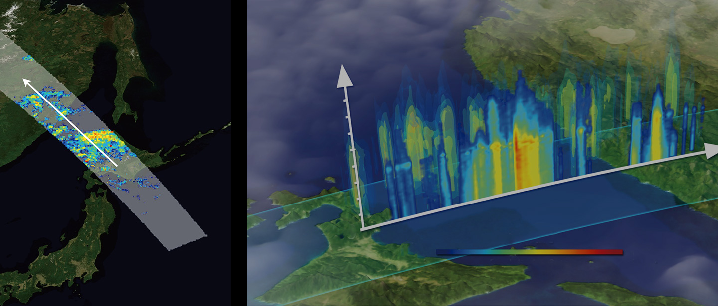
Observing rainfall from space to reduce flood damage
◆Global Satellite Mapping of Precipitation (GSMaP) (Global Rainfall Watch)
JAXA has released the Global Satellite Mapping of Precipitation (GSMaP), which provides hourly global precipitation data by integrating data from meteorological satellites in Japan, the United States, and Europe. In the case of natural disasters such as typhoons and torrential rains, it is a major issue for meteorological and disaster management organizations to improve their understanding of the precipitation distribution in areas where observations by ground-based rain gauges and meteorological radar are difficult, as well as at sea. GSMaP is used by meteorological organizations and disaster management agencies that having such issues in about 140 countries around the world. In addition, JAXA is engaged in the efforts to predict flooding. We use satellite precipitation data to understand the amount of precipitation in the upstream areas of international rivers, where it is difficult to obtain the observation information, and predict flooding in downstream areas several days in advance, by utilizing ground data as well.
https://sharaku.eorc.jaxa.jp/GSMaP/index.htm
Observing agriculture from space for contribution to stable food supply
◆Utilizing satellite data for crop growth monitoring (Satellite agrometeorological monitoring systems)
If we can accurately monitor the crop production around the world, we can stop the extreme fluctuations in food prices and contribute to the optimization of agricultural markets and the stable supply of food. Crop planting status observed by Earth observation satellites, and agricultural meteorological information such as precipitation, solar radiation, and temperature, which greatly affect the growth of crops, are utilized to monitor the production status of agricultural crops around the world. In addition, JASMAI, a part of satellite agrometeorological monitoring systems developed by JAXA is being operated by the Ministry of Agriculture, Forestry and Fisheries (MAFF), utilizing the results of JAXA.
JASMIN (JAXA satellite monitoring system to contribute to agricultural markets information)
JASMAI(JAPAN’s Satellite Monitoring system of Agrometeorological Information)
Protecting people’s health from air pollution
◆Air Pollutant Monitoring (Himawari Monitor)
JAXA has released the “JAXA Himawari Monitor,” a website to display color images of Himawari 8 and quick-look images of geophysical data. By grasping the flow of aerosols and PM2.5 by Earth observations from space, we can identify the point of occurrence, reinforce the ground observation network, and accurately disseminate pollution forecast information, thereby contributing to the prevention of health hazards caused by air pollution.
Efforts for SDG Indicators
To assess the achievement of SDGs, indicators are set for each of their 169 targets. The indicators are established by the United Nations Statistical Commission and the Inter-Agency and Expert Group on the SDG Indicators (IAEG-SDGs). JAXA has been participating in IAEG-SDGs’ Working Group on Geospatial Information (WGGI) as an expert, and provides advice on how to use satellite data for indicator calculation together with NASA and others. The calculation method of each indicator and data source information are released by the United Nations Statistics Division as metadata.
JAXA promotes the use of Earth observation satellite data for the SDG indicators. JAXA ALOS High-Resolution Land Use and Land Cover Map of Japan is used to calculate the indicators in Japan, including SDG Indicator 11.3.1 “Ratio of land consumption rate to population growth rate” and SDG Indicator 15.4.2 “Mountain Green Cover Index”. In addition, for SDG Indicator 6.6.1 “Change in the extent of water-related ecosystems over time”, the Global Mangrove Watch released by JAXA is described in the metadata as the official data source on Mangrove.
Contribution to SDG 11 “Sustainable cities and communities”
Contribution to SDG 15 “Life on land”
Contribution to SDG 6 “Clean water and sanitation”
SDGs Geospatial Roadmap / Japan’s National Experience in Producing SDG15.4.2
https://storymaps.arcgis.com/stories/d93fb8faa2e84f2fad508ff8859abc93
Estimation of the SDGs indicator 11.3.1 in Japan
https://storymaps.arcgis.com/stories/3f9feba2bb7d4e04b0e00f50cc2d7a50


Stay Connected
