Oil Spill Monitoring
Oil spills in the ocean have a significant impact on coastal human activities, marine life and ecosystems, marine resources, and marine environment. Recently, in August 2020, an oil spill from a ship run around off the coast of Mauritius flowed to the Mauritian coast, resulting in significant damage to animals and plants and fishing activities.
Synthetic Aperture Radar (SAR) observations allow us to grasp a complete picture of damages such as an oil spill. JAXA promptly provided the information to the relevant organizations and local response teams in order to contribute to minimizing the damage through oil clean-up work and support activities in the environmental field.
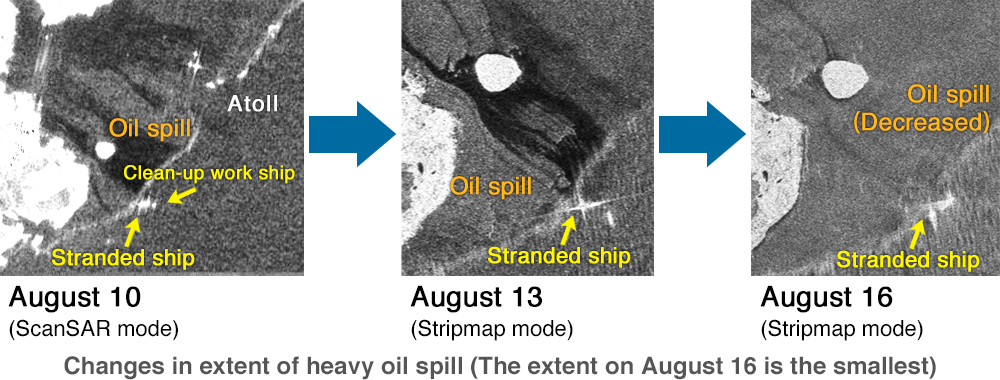
Figure 3-2 ALOS-2 Observation images of oil spill
For more information, visit:
Cooperation for the oil spill incident in Mauritius coast by using
“ALOS-2” observation
Fishery and resource management
The use of satellite data makes it possible to know fishing ground points, which enables efficient fishing, such as saving fuel for fishing vessels. On the other hand, the decline in fish catches is pointed out in recent years, and there are concerns about the decline of fishery resources themselves. Therefore, it is required to properly manage fish catches so that fishery resources can be used sustainably and maximally. There is a growing emphasis on curbing Illegal, Unreported and Unregulated (IUU) Fishing that undermines the effectiveness of such resource management. In these circumstances, in order to assess fish catches in the open ocean, observation data from GCOM-W and GCOM-C, vessel information from satellite AIS, and SAR data are helpful to fisheries, fishery resource management and monitoring illegal fishing vessels.
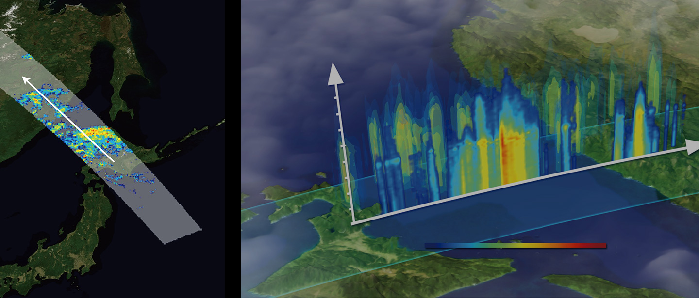
Contribution to the Development of Arctic Sea Route
In recent years, as Arctic sea ice extent has been decreasing due to the effect of global warming, the ship navigation through Arctic sea routes during the summer season has been attracting attention. JAXA, in cooperation with the National Institute for Land and Infrastructure Management, Ministry of Land, Infrastructure, Transport and Tourism (MLIT), Hokkaido Development Bureau, MLIT and Aomori Prefecture, provides SPace based AIS Experiment (SPAISE) and sea ice data from satellites, JAXA is conducting research to understand the actual situation of ship navigation in the Arctic Ocean and to verify the possibility of utilizing the data for port maintenance. In addition, we are also studying the optimal route planning by combining AIS data with marine and meteorological conditions using satellites.
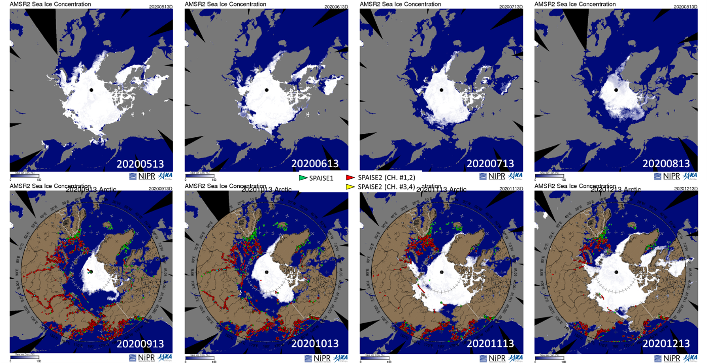
Figure 3-3 Ship distribution by JAXA satellite AIS (SPAISE) and sea
ice distribution by GCOM-W in the Arctic
Ocean (May-December 2020)
Maritime safety and shipping logistics
Spaceborne AIS receivers and SAR enable us to obtain global ship navigation information. In particular, the capability to receive AIS data in open seas, where the ground-based AIS cannot collect information, helps to understand the status of ship navigation in the open seas, investigate the causes of marine accidents, and monitor the individual navigation performance.
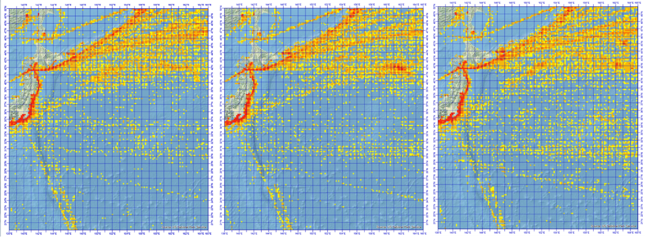
Figure 3-4 Annual ship density distribution over the eastern sea of
Japan (2018-2020)
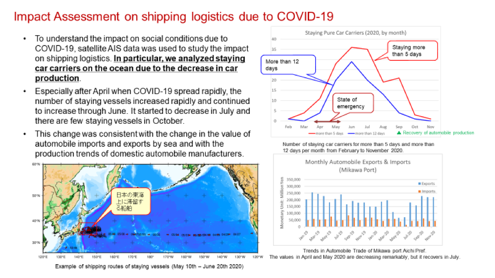
Figure 3-5 Analysis Results of staying car carrier due to COVID-19
For more information, visit:
Impact of COVID-19 on automobile shipping
Observation for the stranded ship and vessel congestion in the Suez Canal
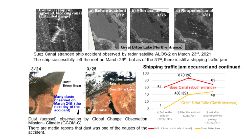
Figure 3-6 Analysis results of stranded ship and shipping traffic jam
in the Suez Canal