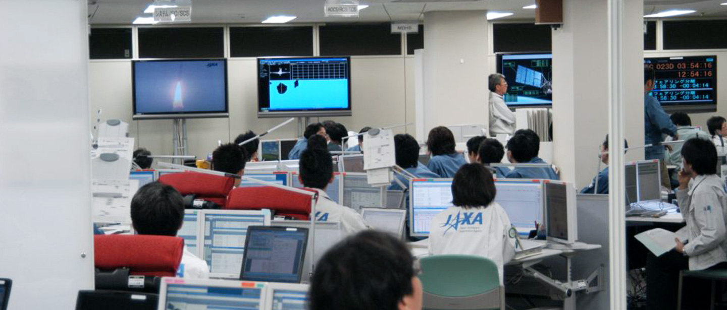
Monitoring the Forests
The Synthetic Aperture Radar (SAR) onboard the Advanced Land Observing Satellite “DAICHI” (ALOS) and “DAICHI-2” (ALOS-2) can observe the Earth’s surface even through cloud and rain. This capability enables ALOS and ALOS-2 to observe forests worldwide, including tropical area with high cloud cover. JAXA joins up the images captured by SAR to create a single, seamless mosaic and analyzes this mosaic to form a global forest/non-forest map, distinguishing forested from non-forested areas of the world. JAXA publishes the mosaics together with conventional maps.
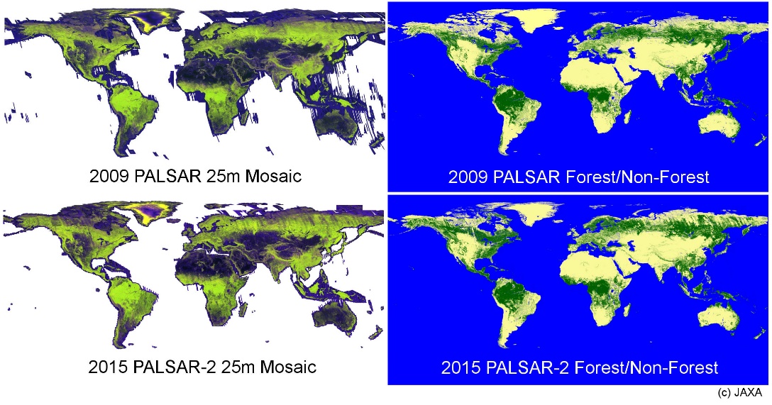
PALSAR and PALSAR-2 Global mosaic and forest/non-forest map (2009, 2015)
Crustal Deformation Monitoring
The Synthetic Aperture Radar (SAR) onboard the ALOS and ALOS-2 can render visible in their entirety deformations in the Earth’s surface caused by earthquakes, volcanic activity, landslides and other geological phenomena, with centimeter-level precision. Using techniques such as Interferometric SAR, EORC applies displacement sampling and conducts research on enhancing its effectiveness. It is also possible to measure the settlement of port facilities and river bank and applied to the advancement of infrastructure management.
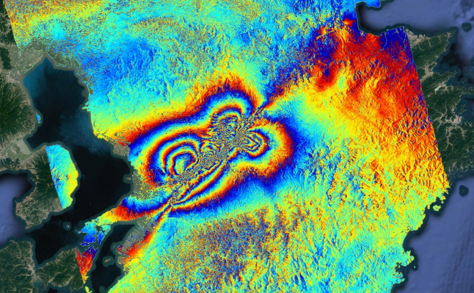
Crustal deformation image associated with the 2016 Kumamoto Earthquakes (strongest temblor reached a magnitude of 7.0.)
(This image was obtained by processing data from the PALSAR-2 Synthetic- Aperture Radar on ALOS-2.)
Land Cover Classification and Ecosystem Monitoring
Land cover classification map is one of the important basic information utilized for simulations of climate, hydrology and ecosystems as well as for policymaking and land conservation such as biodiversity, agriculture, forestry, fisheries, environment, disaster risk reduction and public health.
JAXA creates Land cover classification maps with high resolution at regional and national level by utilizing satellite observation data. We are collaborating with universities and research institutes and working on processing the satellite data to higher levels, development of classification algorithms by machine learning, and maintenance of databases for validation.
We will proceed research development for higher accuracy by utilizing data from Global Change Observation Mission -Climate “SHIKISAI” (GCOM-C), Advanced Optical Satellite “DAICHI-3” (ALOS-3), and Advanced Land Observing Satellite-4 “DAICHI-4” (ALOS-4).
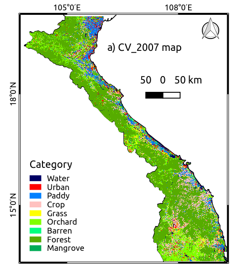
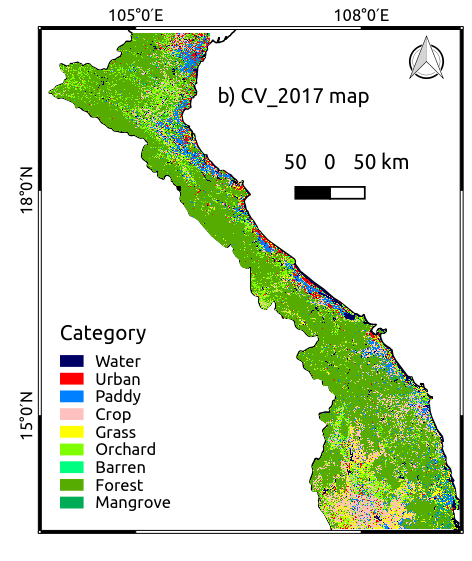
High-resolution land-cover map of central Vietnam