The satellite data used for MDA can be generally divided into two categories: data for monitoring ship movements and data for observing the marine environment such as weather and oceanographic conditions.
Monitoring ship movements by satellites
AIS (Automatic Identification System) and SAR (Synthetic Aperture Radar) onboard satellites are applied to monitor the movement of ships. AIS is a system that automatically sends signals to surrounding ships and land stations with information such as ship’s name, type, position, course, speed, and destination, etc. When AIS receivers are mounted on a satellite, information on ships within a range of about 5,000 km from the satellite can be obtained.
AIS (Automatic Identification System) onboard satellites
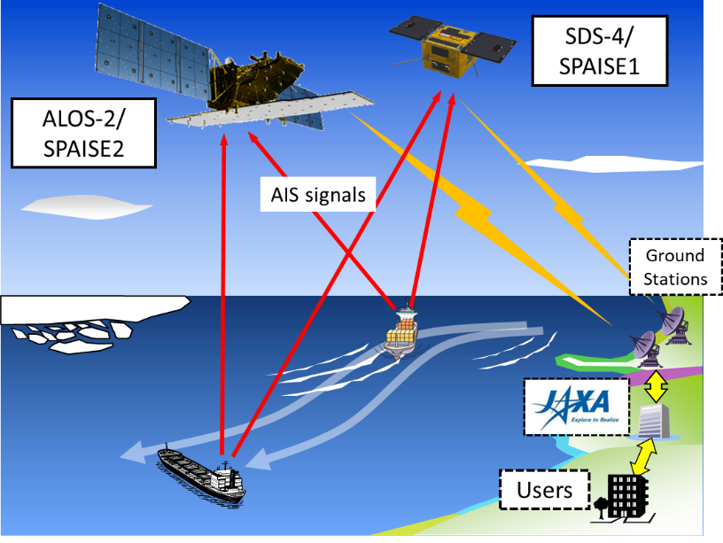
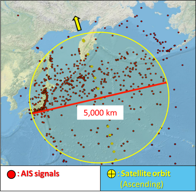
Figure2-1. Operation and Observation range of JAXA satellite with AIS (SPAISE)
Synthetic Aperture Radar (SAR)
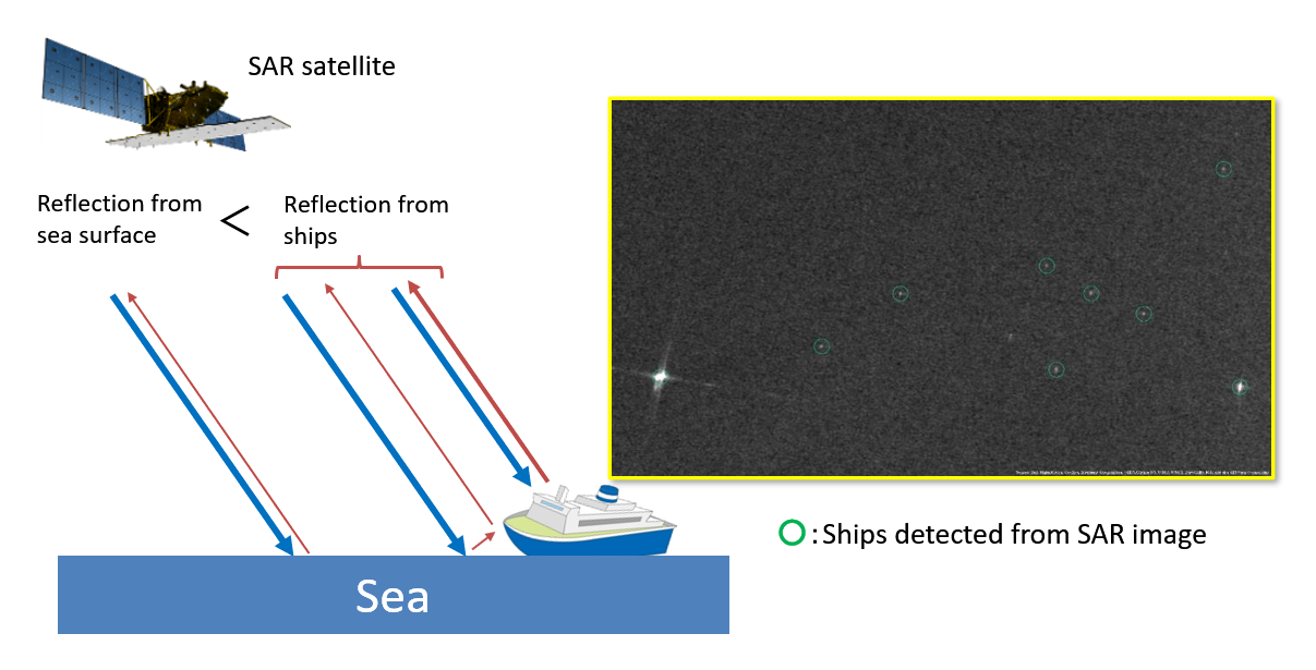
Figure2-2. Concept of ship observation using SAR
Combined Use of AIS and SAR for monitoring ship movements
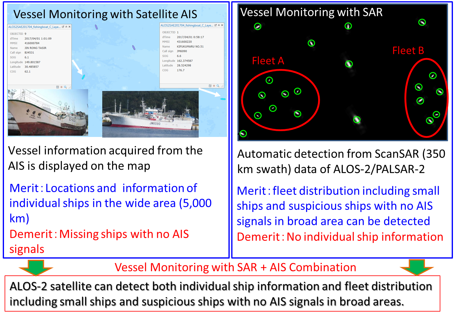
Figure2-3. Concept of Combined Use of AIS and SAR for monitoring ship movements
Related Articles:
Advanced Land Observing Satellite-2 “DAICHI-2” (ALOS-2)
https://global.jaxa.jp/projects/sat/alos2/
Advanced Land Observing Satellite-4 (ALOS-4)
https://global.jaxa.jp/projects/sat/alos4/
Observation of the marine conditions (meteorology and oceanography)
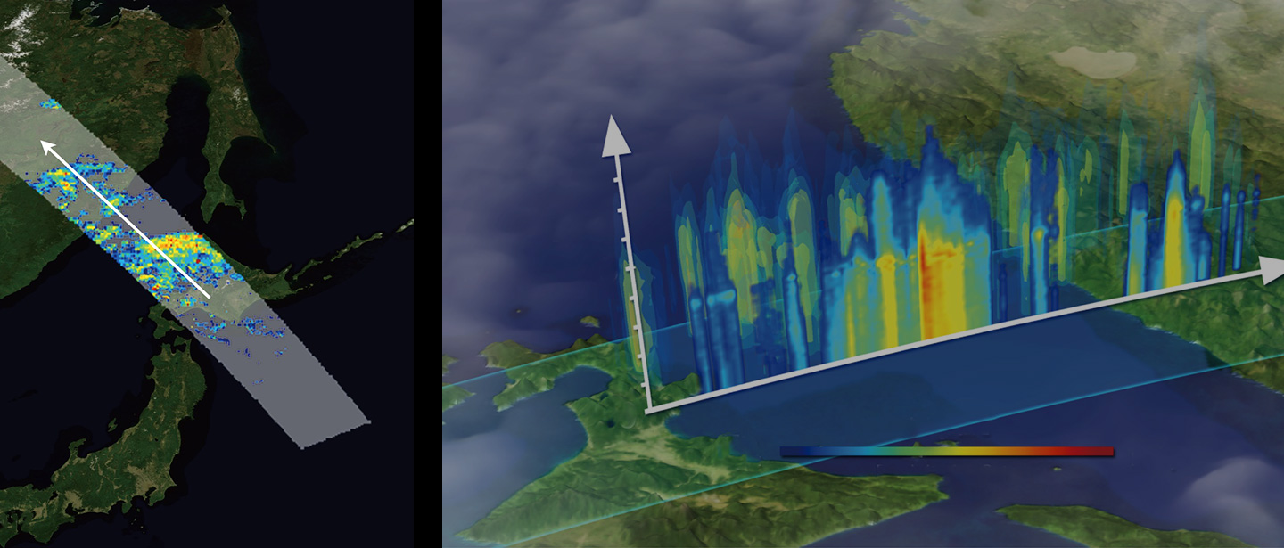
Environmental information (sea surface temperature, chlorophyll concentration, etc.) in the ocean is beneficial for understanding fishing grounds, since there is a correlation between sea surface temperature and chlorophyll distribution and the target fish species of the fishery (Figure 2-4). Furthermore, to avoid typhoons, strong winds, and strong rainfall, weather/sea condition information(wind speed at sea, amount of precipitation, etc.) is necessary for ship navigation.
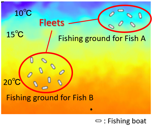
Figure2-4. Sample image of sea surface temperature and target fish species for fisheries
As the ocean is very vast, satellite observations are indispensable to collect the information. JAXA has been providing Global Satellite Precipitation Map (GSMaP) data, which is a combined data from the Global Change Observation Mission-Climate ”SHIKISAI” (GCOM-C), Global Change Observation Mission – Water “SHIZUKU” (GCOM-W), and the Japan Meteorological Agency’s “Himawari”, as well as precipitation data from satellites, to support the understanding of fishing grounds and marine navigation safety.
Data and Satellites for fishing grounds monitoring:
・Sea Surface Temperature: SHIZUKU, SHIKISAI, Himawari
・Ocean Color (Chlorophyll-a concentration): SHIZUKU, SHIKISAI, Himawari
Data and satellites for maritime navigation safety:
・Marine wind speed: SHIZUKU
・Precipitation (GSMaP); GPM/DPR, SHIZUKU
These data are provided in real time to the “Maritime Domain Awareness (MDA) Situational Indication Linkages (MSIL)” operated by the Japan Coast Guard, and can be superimposed on maps with various marine information.
Related Articles:
Ocean research
https://earth.jaxa.jp/en/research/fields/ocean/
Global Change Observation Mission – Water “SHIZUKU” (GCOM-W)
https://global.jaxa.jp/projects/sat/gcom_w/
Global Change Observation Mission – Climate “SHIKISAI” (GCOM-C)
https://global.jaxa.jp/projects/sat/gcom_c/
Global Precipitation Measurement/Dual-frequency Precipitation Radar (GPM/DPR)
https://global.jaxa.jp/projects/sat/gpm/
JAXA GLOBAL RAINFALL WATCH
https://sharaku.eorc.jaxa.jp/GSMaP/index.htm
JAXA Himawari Monitor (P-Tree)
https://www.eorc.jaxa.jp/ptree/index.html