The satellites observe ocean environment, sea ice and ocean color. Also, researches to utilize these
data are conducted.
Ocean Environment Monitoring
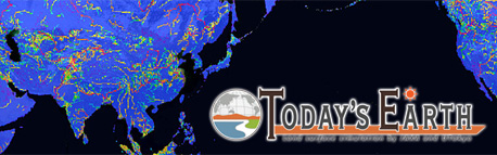
Since the oceans cover some 70% of the Earth’s surface, they deeply connect to our lives through fishing industry, marine transport, and/or marine resource management. Also, the oceans play an enormously important role in global climate change in terms of energy and water cycle, including atmospheric circulation. Satellite observation is indispensable for ocean monitoring which occupies a large area of the earth, and obtained data is utilized in wide range of fields such as meteorology and fishery.
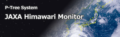
The data related to the marine environment, such as sea surface temperature and wind speed at sea is captured by using the microwave radiometer onboard the Global Change Observation Mission – Water “SHIZUKU” (GCOM-W). JAXA provides the data to related organizations.
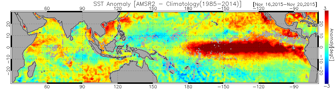
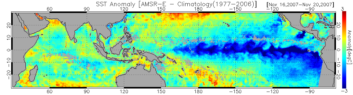
SST anomalies from climatology at during El Niño (upper: 5-day averaged SST from Nov. 16 to 20, 2015 observed by GCOM-W/AMSR2) and La Niña (lower: same as upper but in 2007 observed by Aqua/AMSR-E). Since microwave radiometers are able to observe status of ocean surface through clouds, it is suitable for frequent monitoring of the ocean environment over broad areas.
Sea Ice Monitoring
Sea ice covering the North and South Poles provides an index for measuring the pace of global warming. In the Arctic Ocean, the sea ice cover has shrunk in recent years. This trend reduces the time and cost required to transport goods by ship, raising the attraction of the Arctic as a shipping channel.
Sea ice is observed by microwave radiometer onboard “SHIZUKU” (GCOM-W) and optical sensor onboard “SHIZUKU” (GCOM-C). Also, sea ice observation in high resolution is conducted by using Synthetic Aperture Radar (SAR) onboard ALOS series satellites, such as Advanced Land Observing Satellite-2 “DAICHI-2” (ALOS-2) etc.
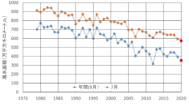
Annual minimum value of sea ice area in the Arctic Ocean (September) and annual change of minimum area in July ©JAXA
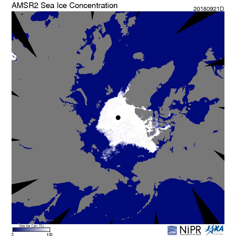
Image of the Arctic sea ice on September 21, 2018 captured by GCOM-W
Ocean-Color Monitoring
The color of the ocean can vary by the type and quantity of photosynthetic pigments such as chlorophyll a including marine phytoplankton, especially in the coast it can by the quantity of suspended solids supplied from the land, such as organic matter and soil particles. By observing the ocean’s color from satellites, researchers can assess the distribution and change of phytoplankton in global scale or the flow of suspended solids in the coasts. Phytoplankton plays a role in carbon fixing through photosynthesis and as a primary producer in the ocean ecosystem. It is expected to be applied to the monitoring of climate change and associated changes in ocean ecosystems, as well as research on the distribution of fishery resources and prediction of changes.
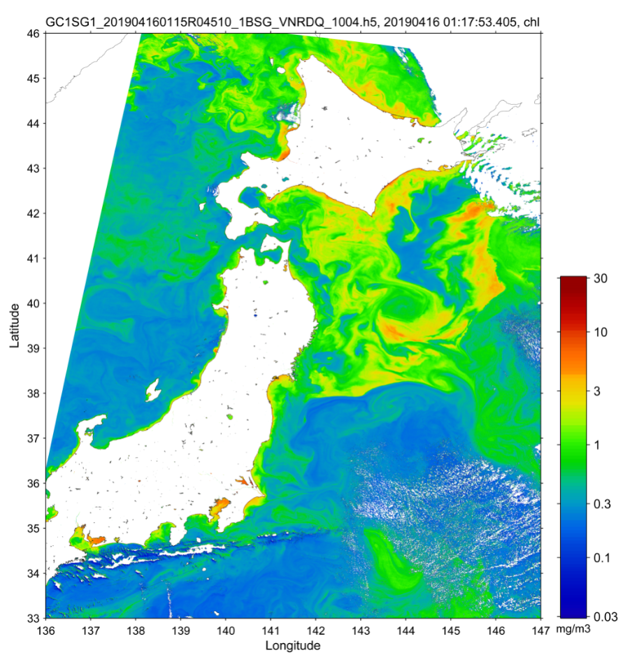
Image of chlorophyll a density around Japan as observed by GCOM-C on April 16, 2019. Phytoplankton propagation (the spring bloom) can be seen from the coasts of Hokkaido to the seas around Tohoku (northeastern Honshu).