JAXA is developing analysis methods utilizing satellite observation data and simulation system in cooperation with domestic research organizations. Not only satellite observation data but also by combination use with numerical models, it is possible to create continuous data and provide physical quantities that cannot be obtained from satellites. By using the method called “data assimilation” which incorporates actual measurement data into simulation, we can estimate unobservable data and predict future condition.
Atmospheric and Aerosol Models
We are conducting research development for incorporating measured satellite data into computer simulations of aerosol transport models (data assimilation) in accordance with external institutions. The aim of this effort is to create a common environmental information about when, where and how much aerosols like yellow dust and PM2.5 are coming.
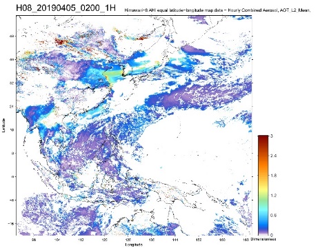
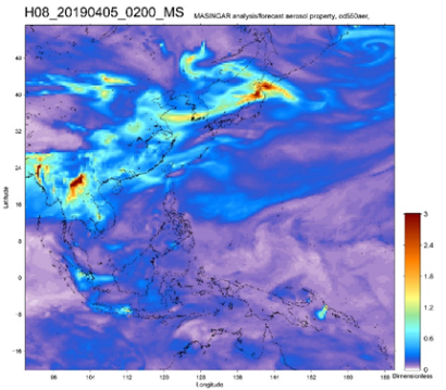
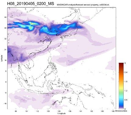
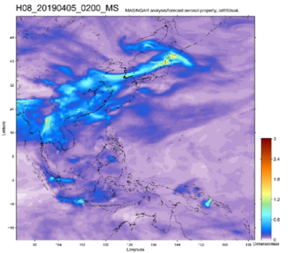
Aerosol optical thickness, 02:00 UTC, April 5, 2019. Upper left and upper right images show the aerosol optical thickness estimated by Himawari-8 observation data and aerosol transport model, respectively. Lower left and lower right images are contribution of the dust aerosol and the sulfuric-acid aerosol to the total optical thickness estimated by the model, respectively.
(The model results are provided by the Meteorological Research Institute.)
Ocean Modeling
Ocean observation by satellites has the advantage of observing global area homogeneously. Satellites can capture the information on the ocean surface, but cannot obtain the data in the ocean or ocean area hidden by clouds.
JAXA is collaborating with research institutions in the ocean field and conducting the research to assimilate satellite sea surface temperature obtained from GCOM-W and Himawari into ocean model with 3-km spatial resolution. Highly accurate ocean information and forecast data without missing gaps are provided through our website.
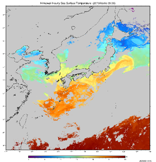
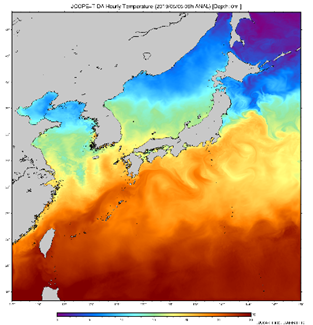
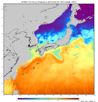
Observation of SST by Himawari at 9:00AM, May 5, 2019 JST (left); Forecast of SST by model with satellite data assimilation (center); Forecast of water temperature at depth of 100m by model (right). By coordinating satellite observations with ocean models, it is possible to estimate and forecast ocean information of underwater and regions where satellites cannot observe.
(Images produced by: JAXA/JAMSTEC)
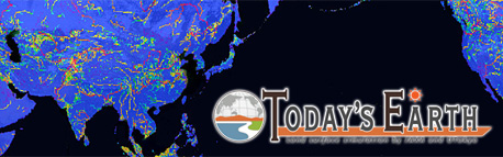
Terrestrial Modeling
JAXA has developed “Today’s Earth (TE)” which is the land surface and river simulation system for disaster monitoring and hydrological research under the joint research with the University of Tokyo. TE derives the conditions of land surfaces and rivers from numerical calculations according to ever-changing climate conditions and provides its results as data and images online.
The data is calculated with a high resolution of 0.5 degrees latitude and longitude for TE-Global, and 1/60 degrees latitude and longitude for TE-Japan. More than 50 geophysical quantities are calculated in total and the results are available online.
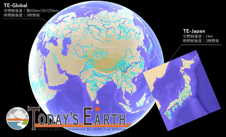
Today’s Earth portal site:
Climate Modeling
In numerical climate models utilized to forecast climate change, such as global warming, there are many uncertainties, especially in dealing with cloud and precipitation processes. So, it is essential to evaluate and improve numerical weather/climate models by data from Earth observation satellites. For this purpose, EORC develops a satellite-data simulator, “Joint-Simulator”, to evaluate numerical weather and climate models using satellite data.
JAXA also developing technology for data assimilation using supercomputer. “NEXRA (NICAM-LETKF JAXA Research Analysis)” assimilates the data of the Global Satellite Mapping of Precipitation (GSMaP) and will contribute to improving the accuracy of future climate prediction.
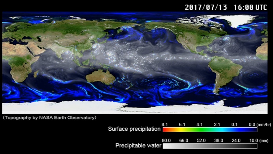
Simulation results using NICAM (Nonhydrostatic ICosahedral Atmospheric Model) performed using JAXA’s super computer (JSS2). A figure shows surface precipitation and column water vapor at 16:00 UTC, July 13, 2017.