


Radar Imagery
Overview
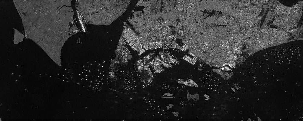
Radar imagery data is obtained by using technology of Synthetic Aperture Radar (SAR) which emits microwaves and captures the reflection characteristic of the Earth’s surface. The data is different from the visible image seen by the human eye and the interpretation of the data needs expert knowledge. Radar imagery data has an advantage to observe the condition of land surface even in the night and on cloudy days.
Taking advantage of the feature that the reflection characteristic of radar differs depend on roughness of land surface, the data is also utilized to observe the distribution and changes in forests, the presence or absence of artificial objects, flooding, and oil spills in the ocean.
Main Product
SAR image
Data Distribution Site
AUIG2
防災インタフェースシステム
K&C Mozaic HP
Related satellites
Advanced Land Observing Satellite “DAICHI” (ALOS)
Advanced Land Observing Satellite-2 “DAICHI-2” (ALOS-2)
Advanced Land Observing Satellite-4 “DAICHI-4” (ALOS-4)


Stay Connected
