


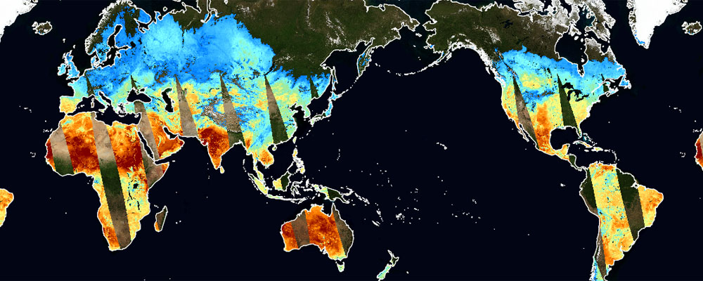
Land Surface Temperature
Overview
JAXA is releasing the data on land surface temperature observed by the Global Change Observation Mission – Climate “SHIKISAI” (GCOM-C), the Global Change Observation Mission – Water “SHIZUKU” (GCOM-W), etc.
The data on land surface temperature is utilized for agriculture field, monitoring of volcanic activity, and risk assessment of forest fire occurrence.
Main Product
Land Surface Temperature
Data Distribution Site
G-Portal
AMSR Viewer
JASMES Portal
GCOM-W Research Product Distribution Service
JPMAP
JAGMAP
Volcano monitoring system
Related satellites
Global Change Observation Mission – Climate “SHIKISAI” (GCOM-C)
Global Change Observation Mission – Water “SHIZUKU” (GCOM-W)
Global Observing SATellite for Greenhouse gases and Water cycle (GOSAT-GW)
Aqua/AMSR-E


Stay Connected
