


Land Cover
Overview
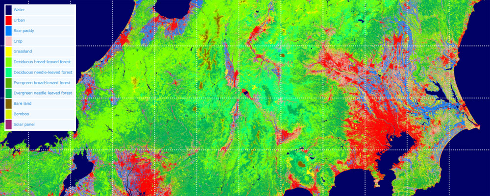
EORC has created the high-resolution land cover classification maps using the data observed by satellites. The condition of land and the status of utilization are classified into 12 categories (Water, Urban, Rice paddy, Crops, Grassland, DBF, DNF, EBF, ENF, Bare land, Bamboo, Solar panel).
The maps are intended to be used as basic information for various applications for the conservation of regions and lands such as ecosystem evaluation (distribution and habitat of animals and plants, various ecosystem services), resource management (agriculture, forestry and fisheries, landscape, etc.), and disaster countermeasures (flood, sediment disaster, etc.)
Main Product
Land Use and Land Cover Map
Data Distribution Site
High-Resolution Land Use and Land Cover Map
Related satellites
Advanced Land Observing Satellite-2 “DAICHI-2” (ALOS-2)
Advanced Land Observing Satellite “DAICHI” (ALOS)


Stay Connected
