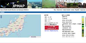
| Description | This site provides environmental data for public health observed by using JAXA earth observation satellites, etc. Web API service has been started. |
| URL | https://www.eorc.jaxa.jp/jpmap/en/index.html |
| Research Field | Land |
| Application | Public health |
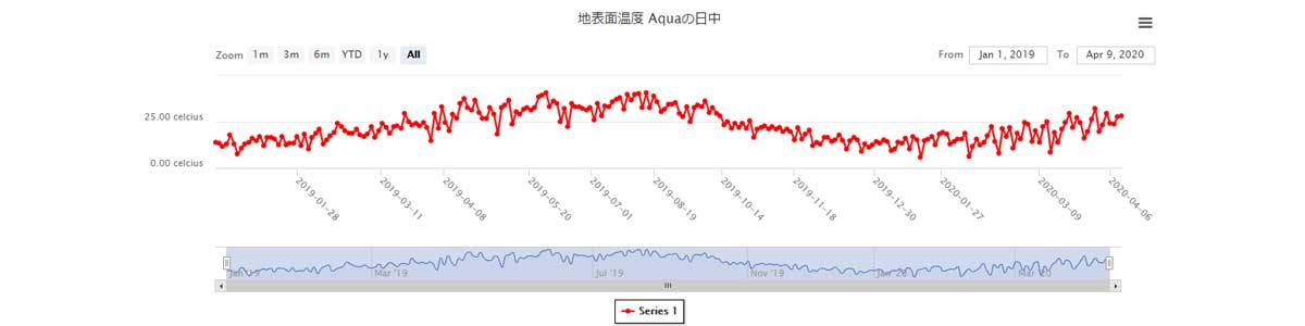
| Product | Rainfall, Short Wave Radiation, Land Surface Temperature, Soil Moisture Contents, Aerosol Optical Thickness (Tau-a), etc. |
| Format | Graph image, Web API, CSV |
| Area | The whole world |
| Period | 2000 – now (depend on the data types) |
| Spatial Resolution | 5km – 30km |
| Temporal Resolution | Every day |
| Terms of Use | This policy is applied. Additionally, not specified items are confirmed to this policy. |
| Tags | Rainfall, Public Health, Land, GPM Core Observatory, SHIZUKU (GCOM-W), MODIS, Multiple Satellites (GSMaP), Download, Search, Daily, Global, Asia, Around Japan, Commercial Use Allowed (Free of charge), Climate, Drought, API |