2025.07.16Activity report
[Event report] SPACETIDE 2025 Panel Session "Unlocking Commercial Space: The Power of Geospatial Data"
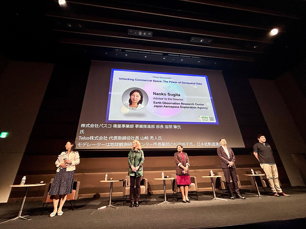
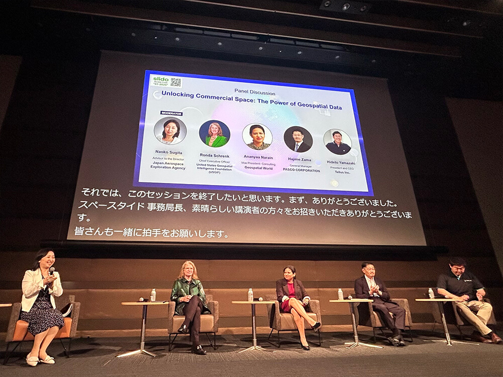
On Tuesday, July 8, 2025, at "SPACETIDE 2025" at the Toranomon Hills Forum, a panel session titled "Unlocking Commercial Space: The Power of Geospatial Data" was held, focusing on the fusion of geospatial information and the space industry.
In this session, key figures from Japan and abroad were invited to engage in lively discussions on how geospatial information can contribute to tackling social challenges such as climate change measures, smart cities, infrastructure development, and disaster prevention.
◆ List of speakers
Moderator
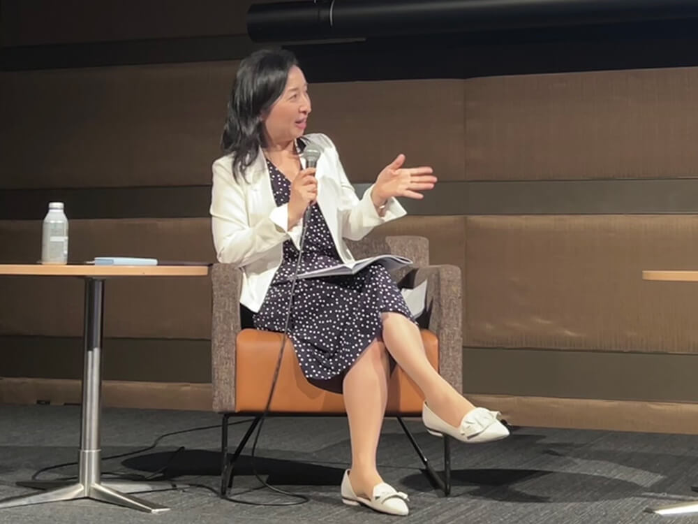
・Naoko Sugita | CONSEO Secretariat/Advisor to the Director, Earth Observation Research Center Japan Aerospace Exploration Agency
Panelists
・Ronda Schrenk | CEO, USGIF (United States Geospatial Intelligence Foundation)
・Ananyaa Narain|Vice President - Consulting, Geospatial World
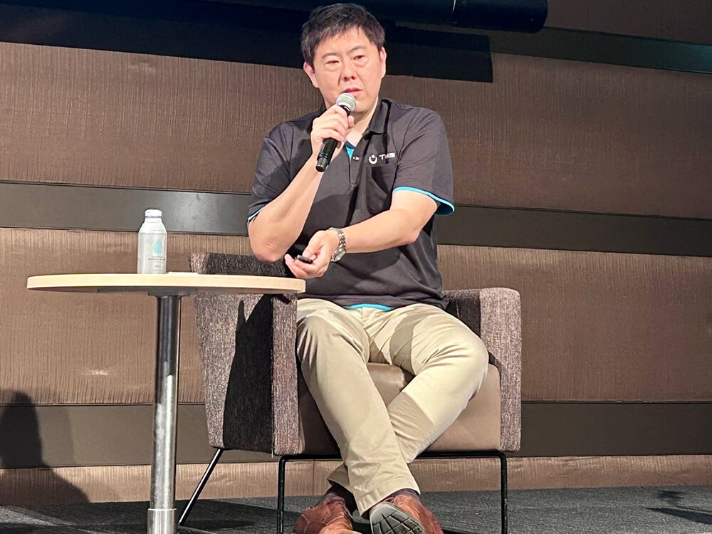
・Hajime Zama | General Manager, Business Development Department, Satellite Business Division, PASCO Corporation
・Hideto Yamazaki | CEO, Tellus Inc.
◆ Opening: Now is the time for satellite data to be an important tool in tackling global challenges
“Satellite data may not sound exciting as likes going to the Moon or Mars, but it plays a crucial role in addressing global challenges,”
Ms. Naoko Sugita pointed out as she opened the session by highlighting the social implementation of geospatial information and satellite Earth observation data.
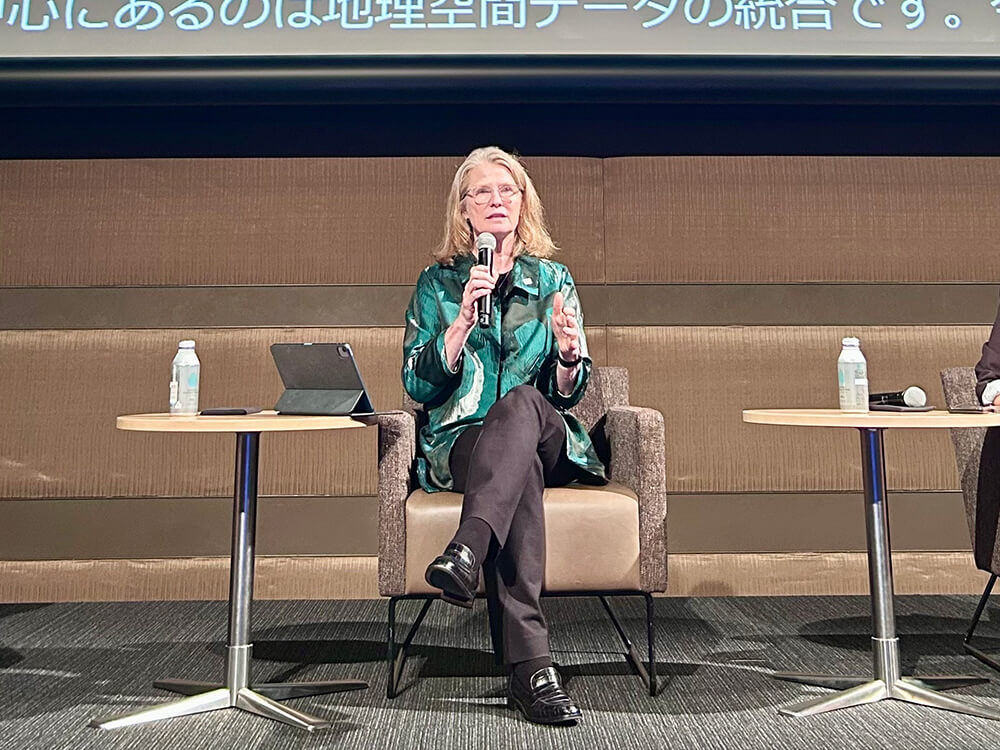
◆ Ronda Schrenk | Geospatial data has become essential and commonplace in addressing global challenges
“Geospatial data is supporting everything from conflict monitoring to climate analysis”
Ms. Ronda Schrenk emphasized that geospatial information has become essential in national security and disaster response, as well as in private and public interest areas such as climate change and supply chain management.
She highlighted areas of particular interest, showcasing examples including the visualization of methane gas emissions using hyperspectral satellites and the observation of carbon sinks (forests).
She also touched on not only the volume of data, but also on intelligent tools that can derive insights from it, as well as the kind of talent equipped with the technical skills to extract meaning from that data.
She also cited the example of how we use geospatial data unconsciously, such as when we use Google Maps on our smartphones to get to our destination, and said that within the next five years, it will become so commonplace that we won't even notice it.
She also suggested that we need to recognize that all events in the real world occur "at a certain place and time." In particular, she said that by viewing things along the four axes of "X, Y, Z, and T (time)," we can for the first time understand the world as "3D + time" and gain the ability to predict what is happening now and what will happen in the future.
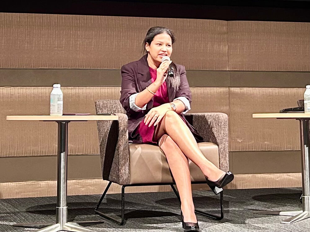
◆ Ananyaa Narain | Geospatial and space are inseparable, and cross-disciplinary dialogue and collaboration are essential
Ms. Ananyaa Narain from Geospatial World introduced changes surrounding the geospatial and commercial space industries, such as market expansion and accelerating privatization, and noted that the focus of investment is shifting from hardware to applications.
She also mentioned that areas such as climate change, disaster response, infrastructure, and smart cities will be areas of focus going forward, and that there is a high possibility of increased investment.
In addition, she mentioned that space data and geospatial data are inseparably related, highlighting that “geospatial data needs space data as much as space needs geospatial to be commercialized.” She used Google Maps as an example to show how the two are already integrated into our daily lives.
Furthermore, she emphasized that dialogue and collaboration between players in different fields, such as space and geospatial information, will become increasingly important in the future, and touched on the need for collaboration beyond silos, as well as the importance of building the technological infrastructure and partnerships that support this.
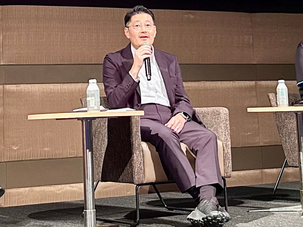
◆Hajime Zama | The importance of co-creation with users through field demonstrations
Mr. Hajime Zama from Pasco introduced examples of demonstration projects he has undertaken to date, including electricity demand forecasting and deforestation detection.
He also introduced examples of using 3D data obtained from satellite images to detect deterioration of infrastructure structures and support the design of power infrastructure, and touched on the importance of working with users to create practical geospatial solutions.
He emphasized that “this social demand for existing data and the increasing data of the satellite, this is going to be very nice to be a solution for the infrastructure.”
Furthermore, he mentioned that a lot of existing data, such as GIS, has already been compiled from the perspective of infrastructure monitoring and disaster response, and stated that by using such existing data as training data and combining it with satellite data, it could lead to effective solutions. He also highlighted an initiative by Marble Visions involving a satellite system capable of high-frequency 3D Earth observation and advanced digital map applications.
◆ Hideto Yamazaki | Collaboration with AI and the development of technological infrastructure and environments are required
Mr. Hideto Yamazaki from Tellus introduced the satellite Earth observation data platform provided by his company, and then presented a new service that allows users to obtain and request observation data from multiple satellites for a specific observation point.
He commented “it's impossible for human beings to utilize all the massive amounts of data there. So we have to work with AI.” With this remark, he underscored the necessity of collaboration with AI to cope with the ever-increasing volume of data, and he highlighted the importance of developing the technological infrastructure and environment needed to process the massive amounts of data that are beyond human capability.
◆ Naoko Sugita | Towards space development as an "information industry"
Ms. Naoko Sugita from the CONSEO Secretariat stated that the traditional role of space agencies is changing from a manufacturing-like position, and that there is now a strong demand for them to function as "hubs" connecting industry, academia, government, and global players.
She also introduced the efforts of the Consortium for Satellite Earth Observation (CONSEO), a platform for collaboration among industry, academia, and government in the field of Earth observation. She highlighted that, in the approximately two years since its establishment, the number of members has grown to nearly 300, reflecting the steadily increasing interest and expansion within Japan.
She emphasized an important shift in perspective, stating, “In Japan, space development is often seen through the lens of manufacturing, but we need to shift our perspective and start viewing it as the information industry.” With this remark, she underscored the need to move beyond “manufacturing perspective” of geospatial information and satellite data utilization, and instead redefine the field as part of the information industry.
She also emphasized that this is an area where social implementation will only progress through co-creation among a diverse range of players, and that it is essential to build partnerships and dialogue that include a global perspective in addition to those between industry, academia, and government.
◆Editor's Note|Connecting across borders and continuing dialogue──CONSEO as the starting point for social implementation
A point that was repeatedly made throughout this session was that geospatial information and satellite data are already becoming indispensable as the foundation of our social and economic activities.
Space and geospatial information are inextricably linked, and technological innovation is increasing the potential to provide unprecedented insights and solutions to fundamental challenges facing humanity, such as climate change measures, smart cities, disaster prevention, and infrastructure conservation.
At the same time, to make these capabilities truly usable in society, the accumulation of data and technology alone is not enough. It is essential to find common goals and engage in steady dialogue not only with industry, academia, and government players involved in satellite data, but also with players from other industries who have knowledge based on geospatial information, and with a variety of stakeholders across countries and fields.
It is important to foresee and design this co-creation process, and I was reminded once again that CONSEO should act as the starting point, a "hub" that connects all the parties involved and creates dialogue.
Toward the realization of a "transparent society," CONSEO will continue to bridge technology and society, space and geospatial space, and different fields, engaging in dialogue with all stakeholders to advance the social implementation of satellite Earth observation data.